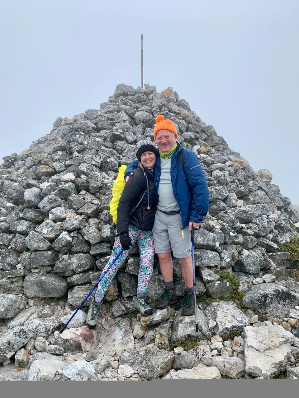
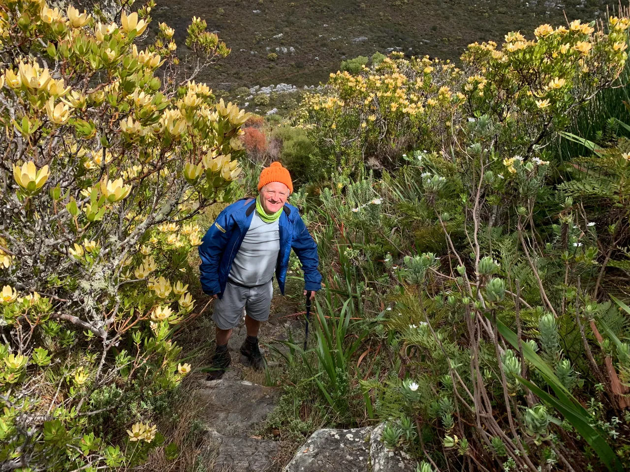
Me and “Uncle” Chris my hiking buddy
We took on the epic hike covering a large portion of Table Mountain, the icon of Cape Town and one of the Wonders of the World.
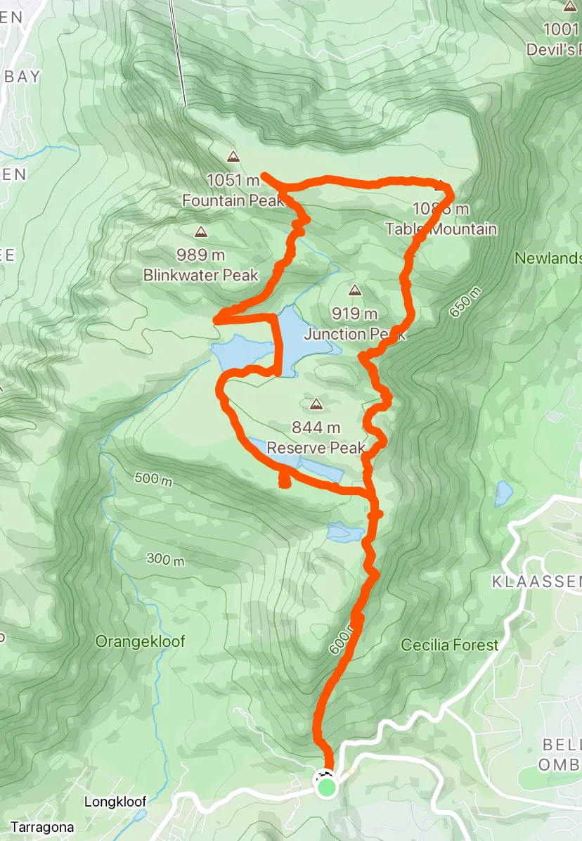
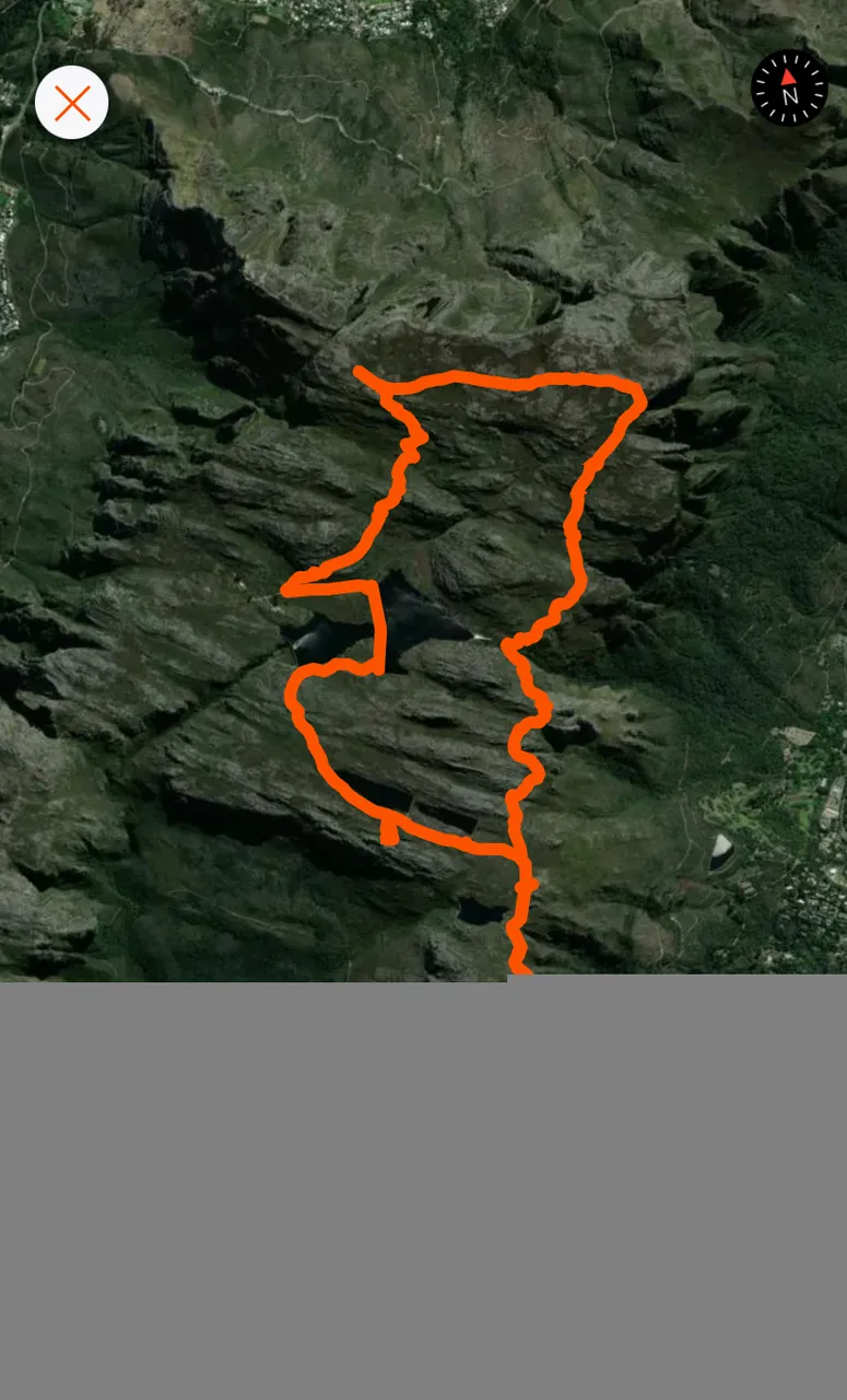
The hike would take us from Constantia Nek, up the slopes to the Overseers cottage on top of the first section, across to the top of Nursery Gorge, then Skeleton Gorge and onward to Maclears Beacon. Then the return part of the circular route via Echo Valley and the 5 dams on top of Table Mountain.
I’ve been wanting to do this one for quite a while and we finally found a day in the week to get up there even though the weather wasn’t perfect.
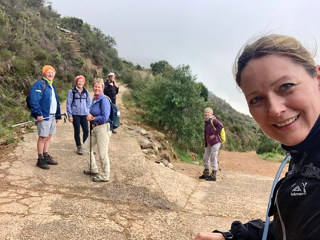

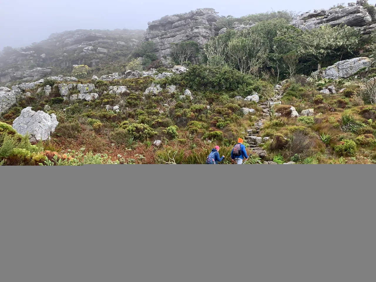
We started at Constantia Nek carpark and took the first 2 sets of steps up the first major ascent. There’s no time for a warm up here. It’s just straight up from the very beginning.

We then took the jeep track passed the steel bridge and passed De Villiers dam (in the fog) and the Overseers Cottage.
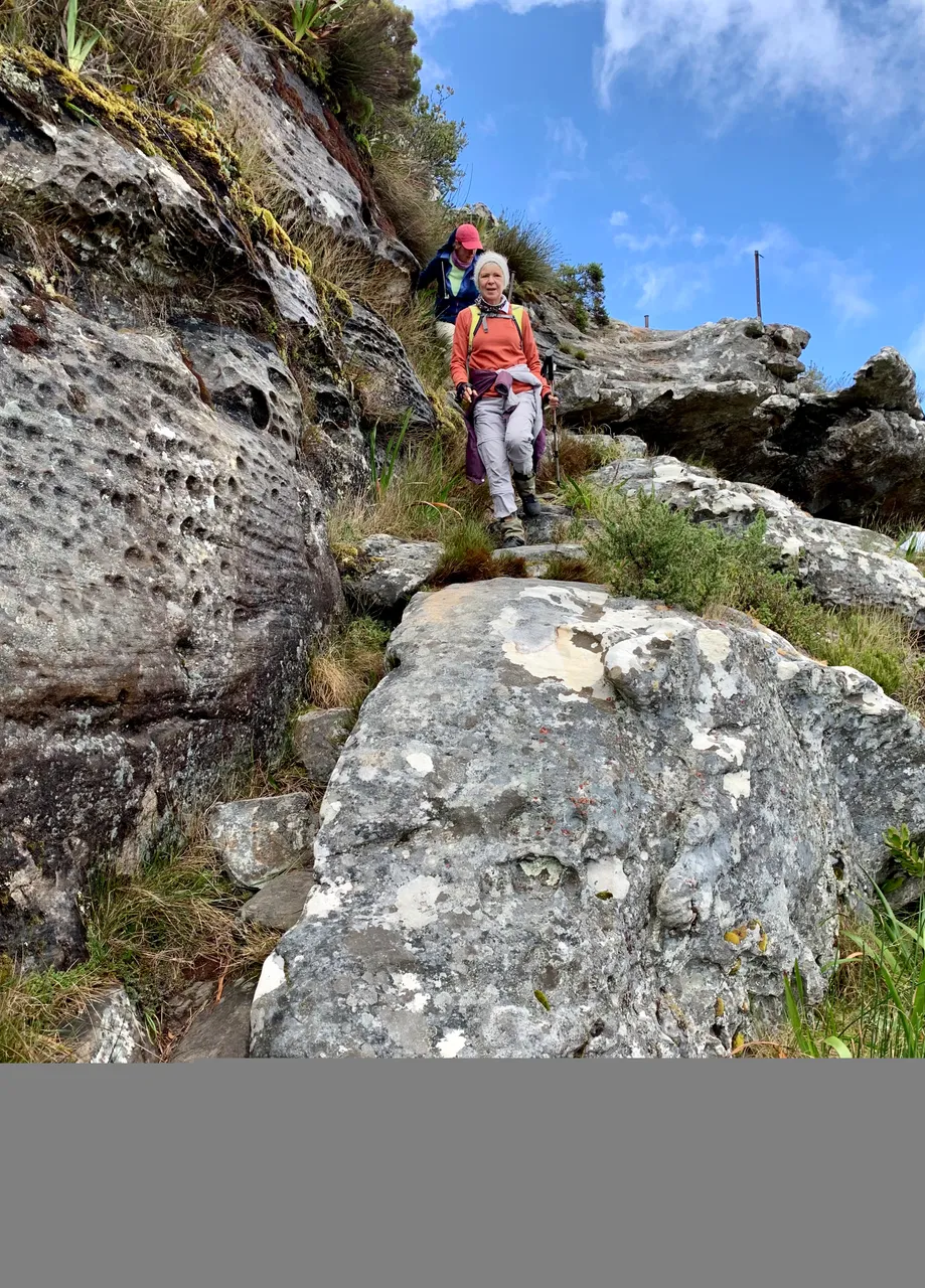
Shortly after the Overseers Cottage we took the single track path to the right at the first map post towards echo valley.
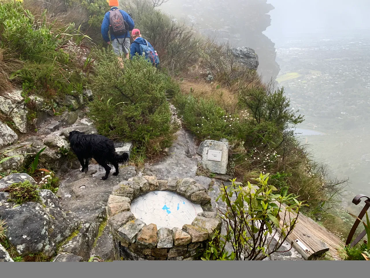
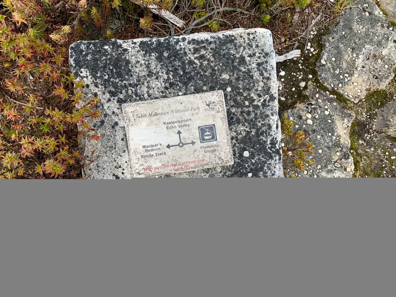
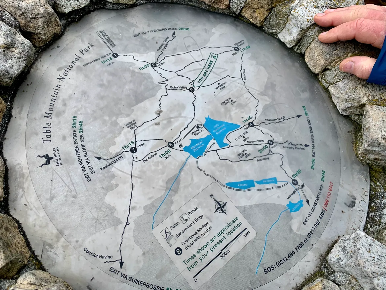
The Nursery Ravine map
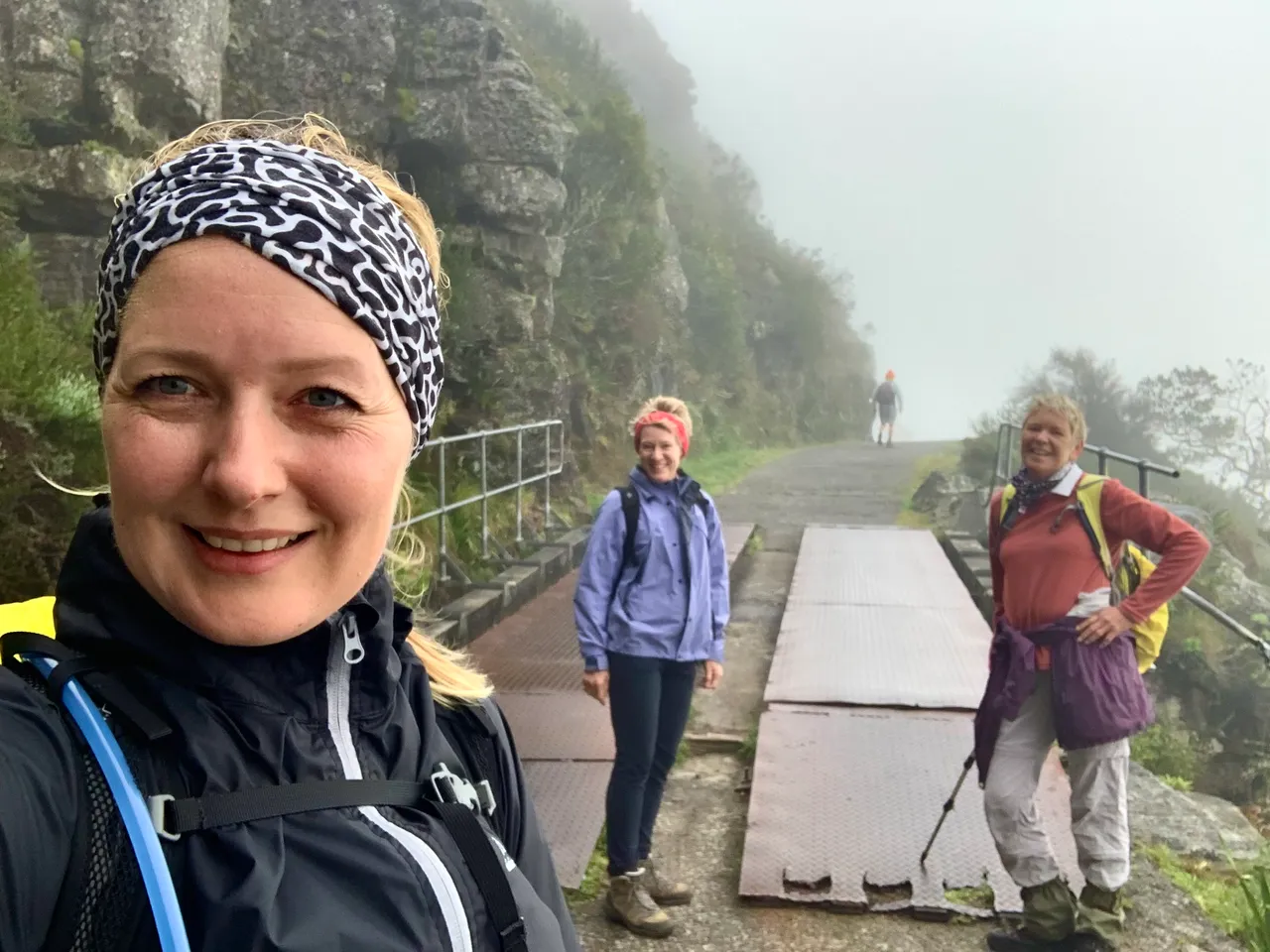
It was an interesting few ups and downs that got us to the top of Nursery Ravine and then Skeleton Gorge and the next map post where we had a good cup of hot tea! The mist and wind were freezing!!! Not for the feint hearted or newby hiker.
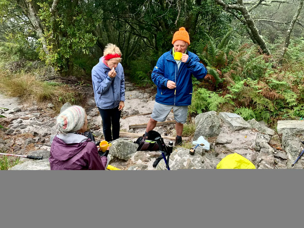
Top of Skeleton Gorge - hot tea spot
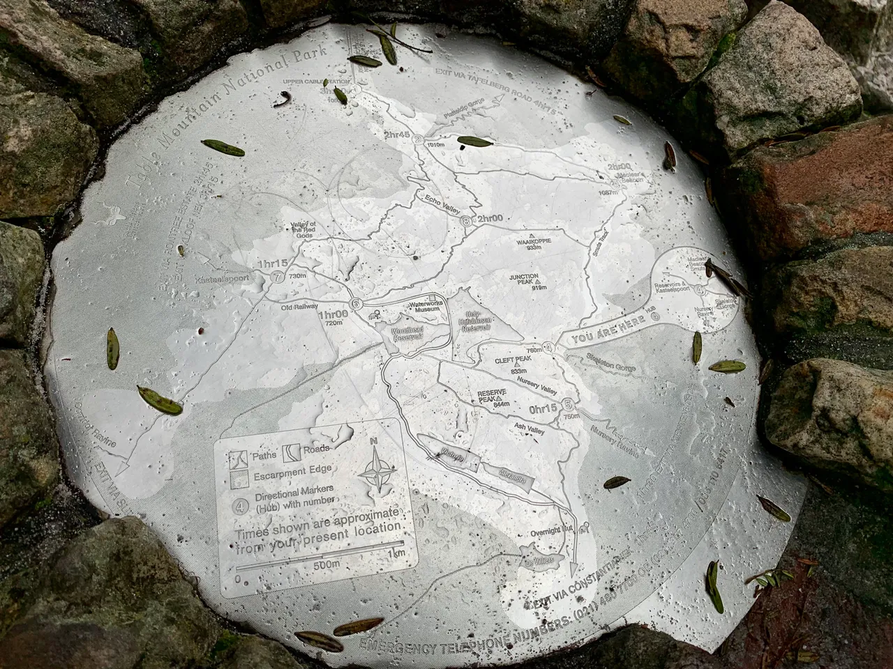
You are here
From there we took Smuts track around the back edge of the mountain. I’m sure the views would have been incredible but we couldn’t see a thing beyond the bush around us.
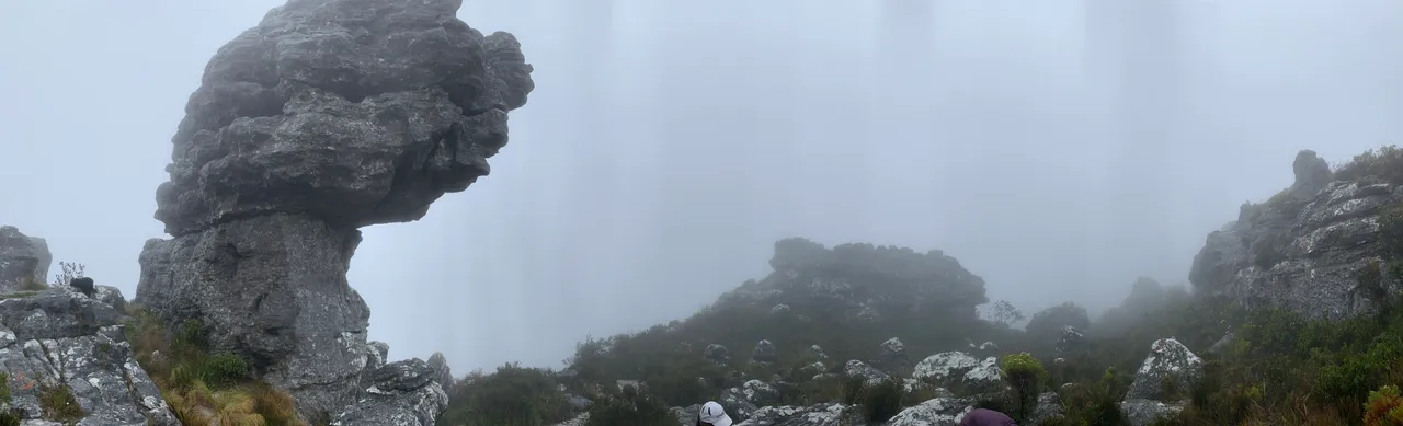
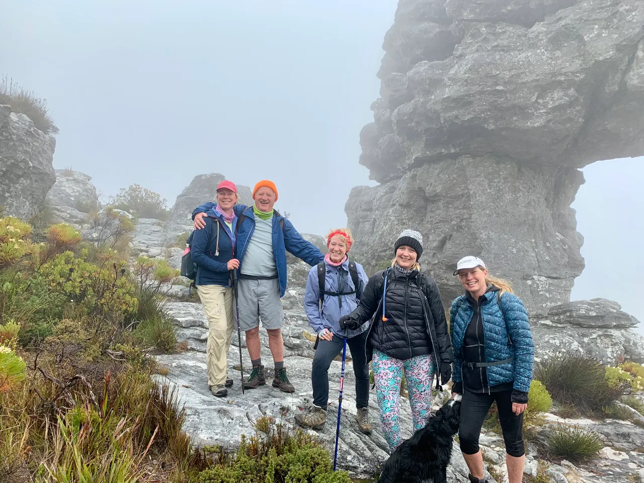
After the Disa Valley (we will be back in January to see them in bloom) we climbed passed a very large rock formation and had to stop for a group photo in the fog.
Arriving at Maclears Beacon was somewhat of an anticlimax. I think it may need to be renamed MACLOUDS.

I’ll have to come back and do this one again just for the views on a clear day, but maybe get here via a different route for adventure sake.
No time to rest - it was just too cold to wait around - we headed on towards Platteklip Gorge on top of Table Mountain until we spotted the small sign on the ground that pointed us back towards KasteelPoort and Echo Valley (we overshot this turnoff and had to backtrack a little bit. I reckon the Cablecar would have been closed in this weather anyway.
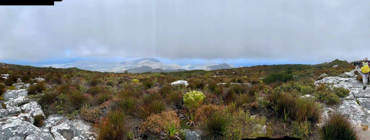
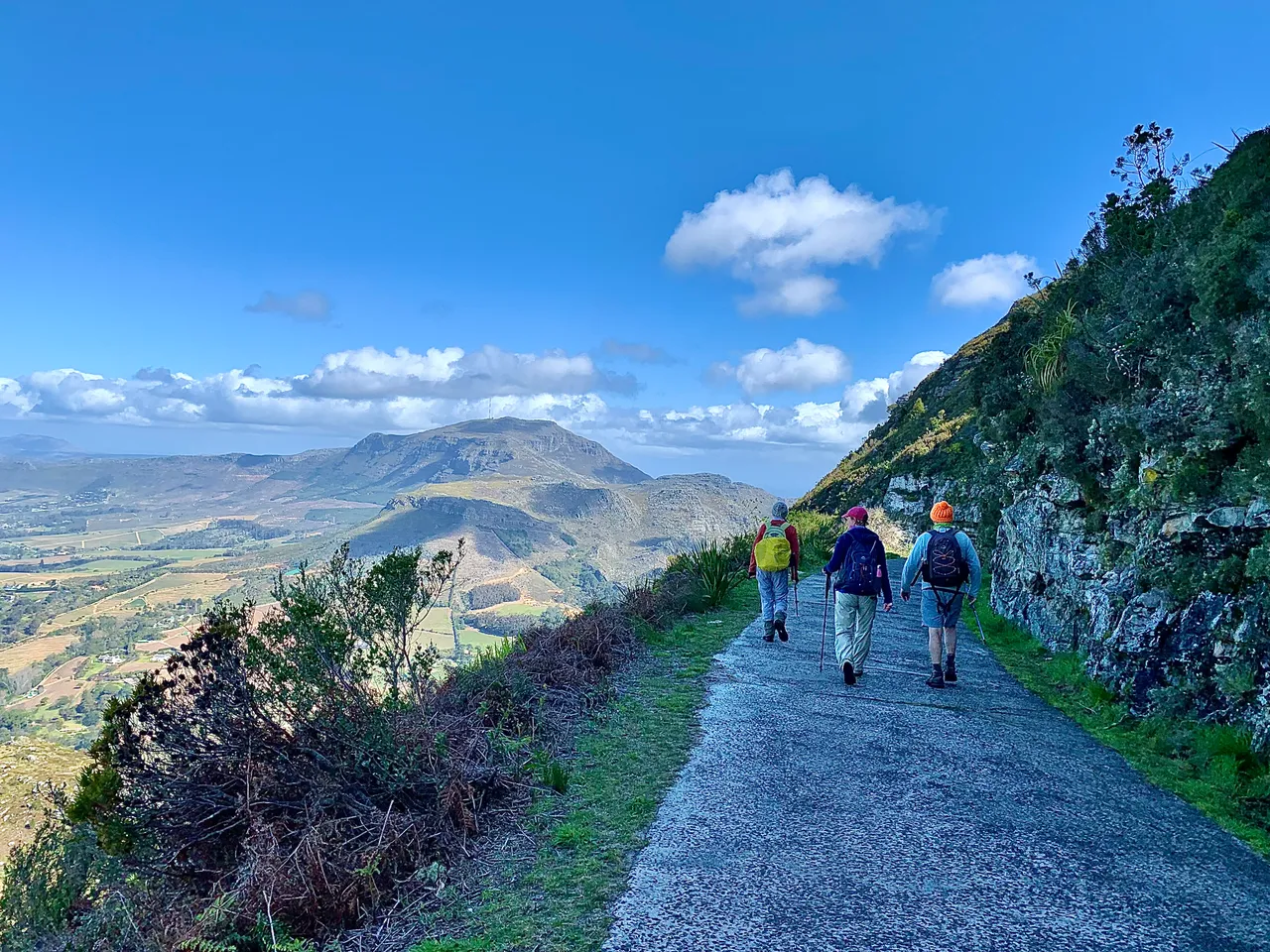
As we walked the clouds gently lifted to reveal the most beautiful view of Hout Bay down on our right and False Bay on our left - each a different ocean on either side of the Cape Peninsula land mass.
We had only seen 2 trail runners on the initial steps and then no one from De Villiers Dam onwards. We were the only ones nuts enough to hike in this weather.
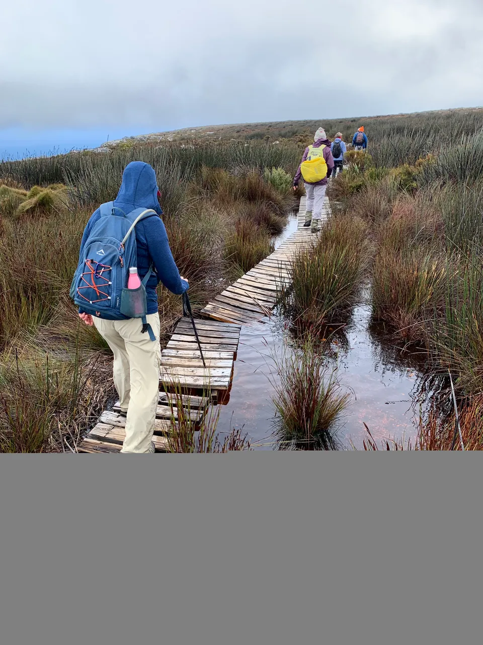
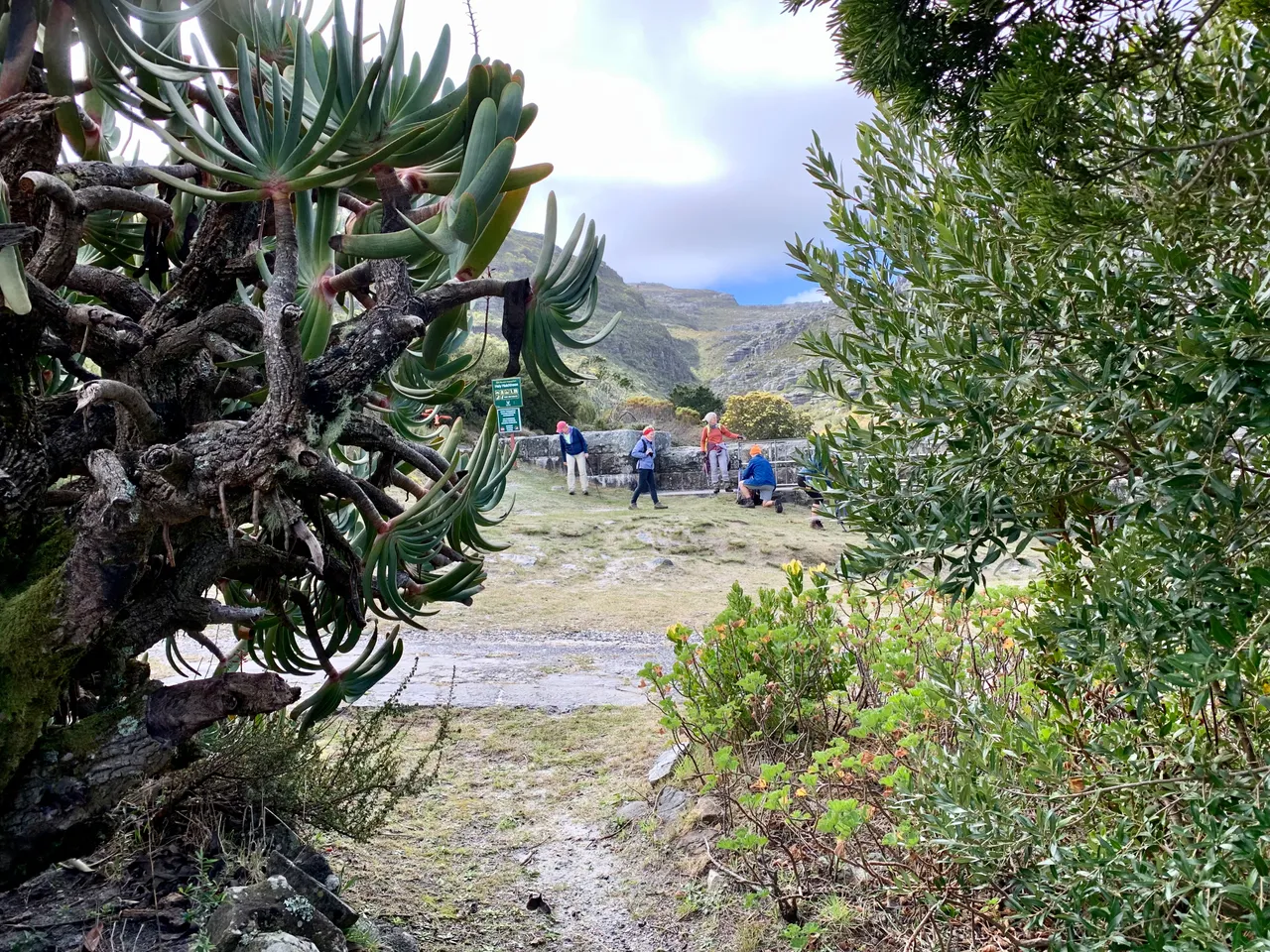
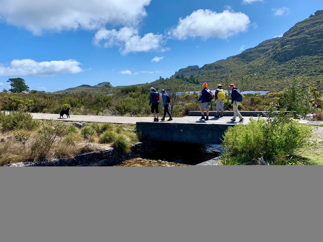
We made our way down flower filled slopes into Echo Valley to the next map post. And then continued on over the next ridge.

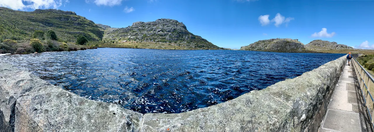
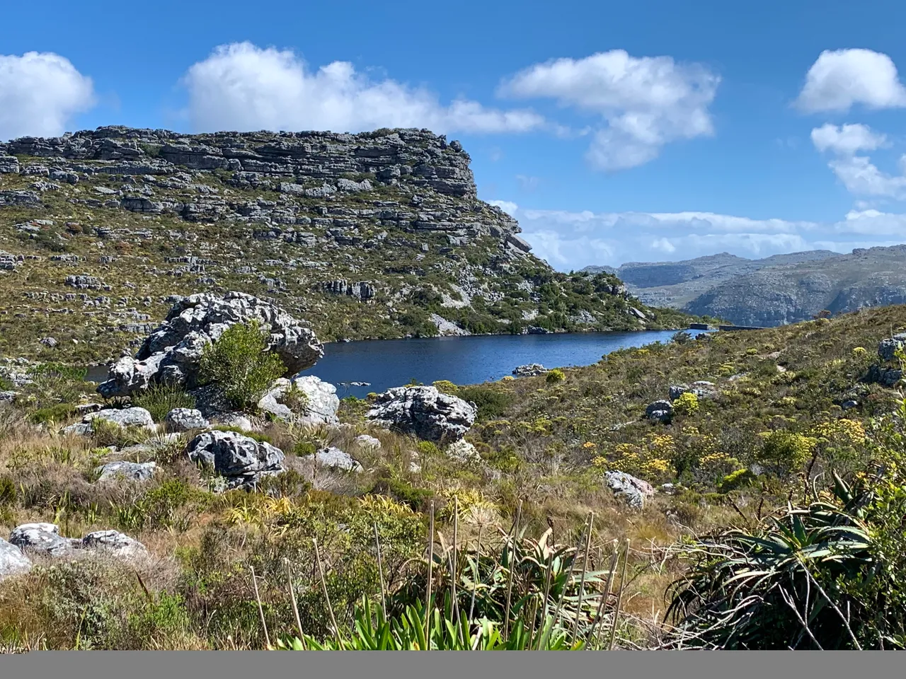
The descent had a couple steep sections that the boarder collie jumped down with ease. We had perfect views of the Helly Hutchison and Woodhead Dams. The Hely overflows into the Woodhead and it was such a privilege to see them filled to the brim.
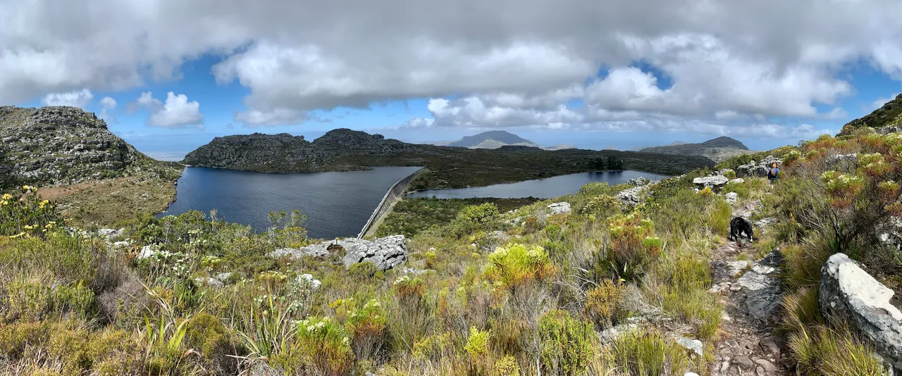
We got to have lunch at the dam wall between the Hely Hutchison and Woodhead Dams. I’ve seen these dams from the Skeleton Gorge side of the Hely Hutchison before, but it was before the winter rains when they were quite low and now they looked beautifully full with Hely Hutchison gently overflowing into the Woodhead.
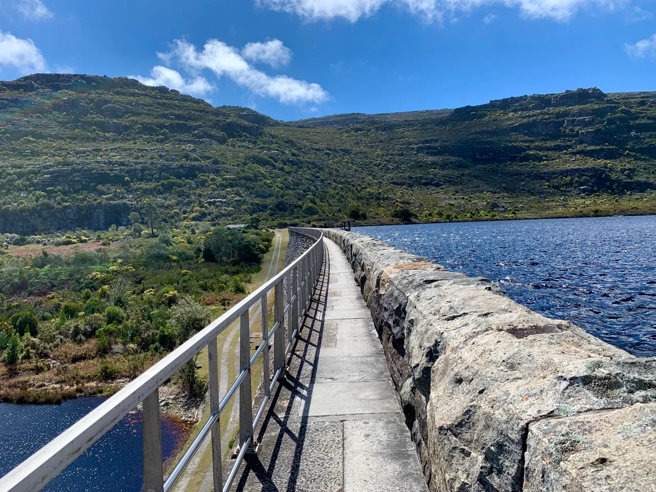
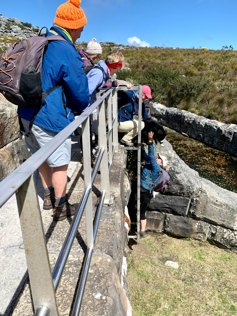
walking the Hely Hutchison Dam wall
This section of the hike started on the Hely Hutchison dam wall. The ladder at the end was a surprise so we quickly mad a plan to pass Gypsie the Boarder Collie down.
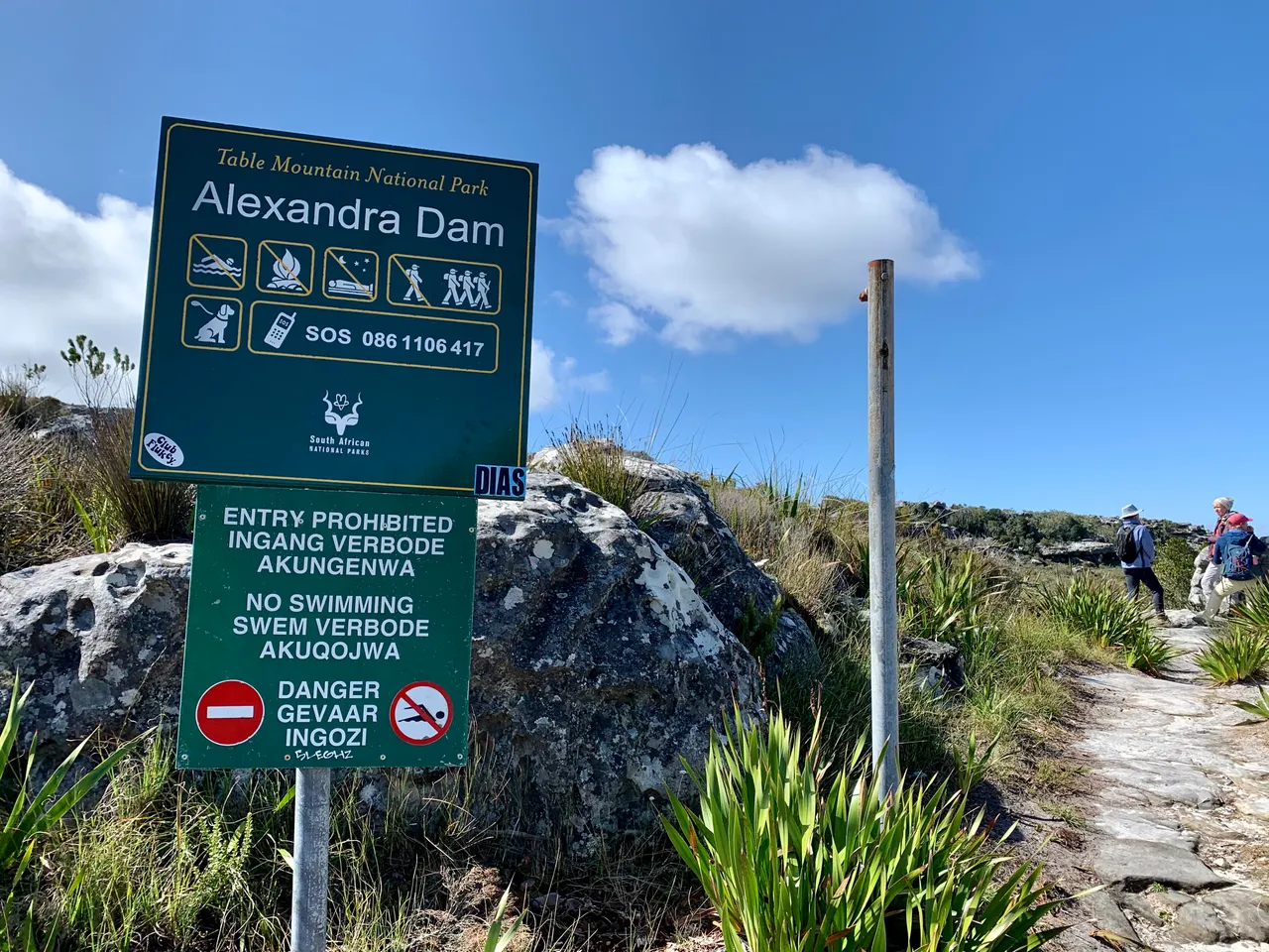
The jeep track took us from Woodhead Dam around another peak towards Victoria Dam and Alexandra Dam where we made a quick detour to look at a local rock formation.
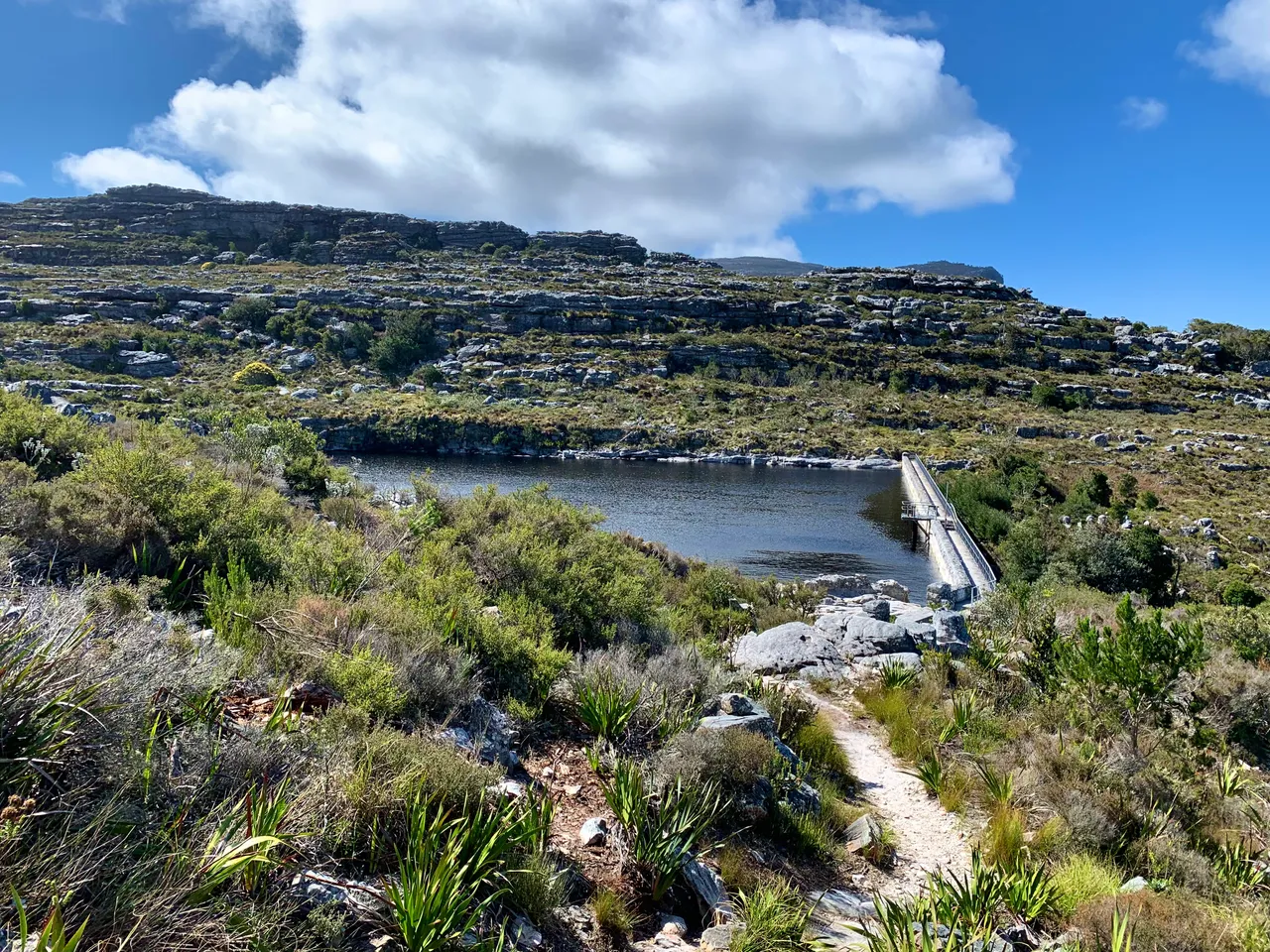
Victoria Dam
We had now officially completed the circle arriving back at the first map post, we continued on to the final dam.
Devilliers Dam
This time De Villiers Dam was in sunshine and looked gorgeous. Still all jacketed up due to the cold southerly wind, it was not inviting enough for us to swim but in summer it’s always an option.
Lastly the final descent. This was the first time that my knees began to whine and the steps down were probably less painful than the jeep track.

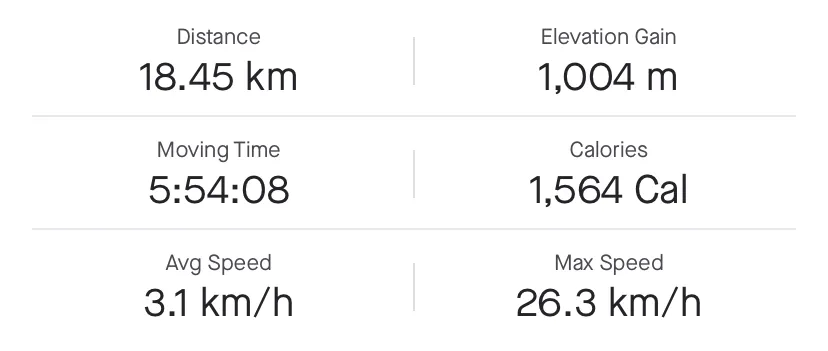
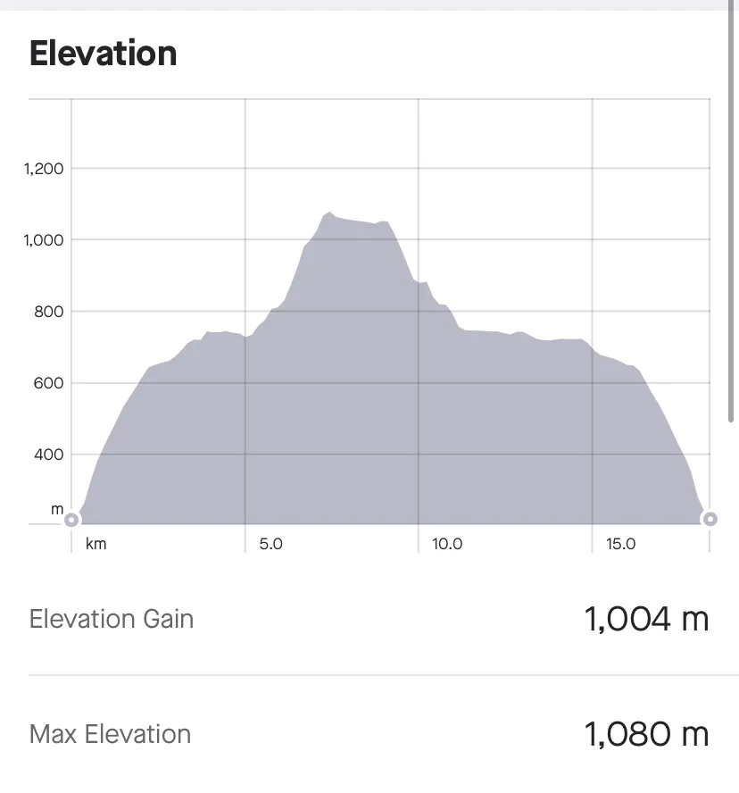
1004 meters of elevation is no joke, but after the initial climb the rest felt more spread out and easier going, until that final descent of course.
It’s also interesting to see the measurements of the various devices as Strava measured 18.45kms, Fitbit measured 20kms and another read 21kms. I guess it’s all somewhere around those numbers and a slightly different route could change the numbers quite a lot.
This is a brilliant hike that I would definitely do again (to see the views next time) but would suggest it for experienced hikers, who have a good idea of the various paths, take maps.me or similar in case of fog (like we had) and plenty of food and water and decent waterproof jackets.
A great hike for when you have a whole day to be out on the mountains.
Until next time…