Preamble
The last day of our trip in Switzerland ended up being the highlight of our time spent in the country and possibly of our entire time within Europe. We hiked the Shilthorn, which is a mountain peak located in the Lauterbrunnen Valley that is famous for Piz Gloria, a restaurant, museum and panoramic lookout at the summit of the mountain. It was also the set for the 1969 film, James Bond, "On Her Majesty's Secret Service," but that's not what this post is really about. It's about our hike up the mountain to Rotstockhütte, the route we took with directions and the sites we saw along the way. I hope you enjoy.
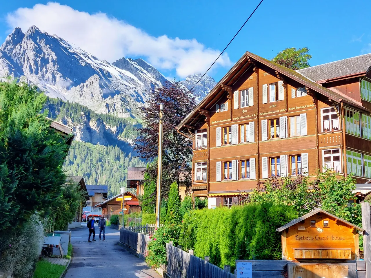
Stechelberg to Murren
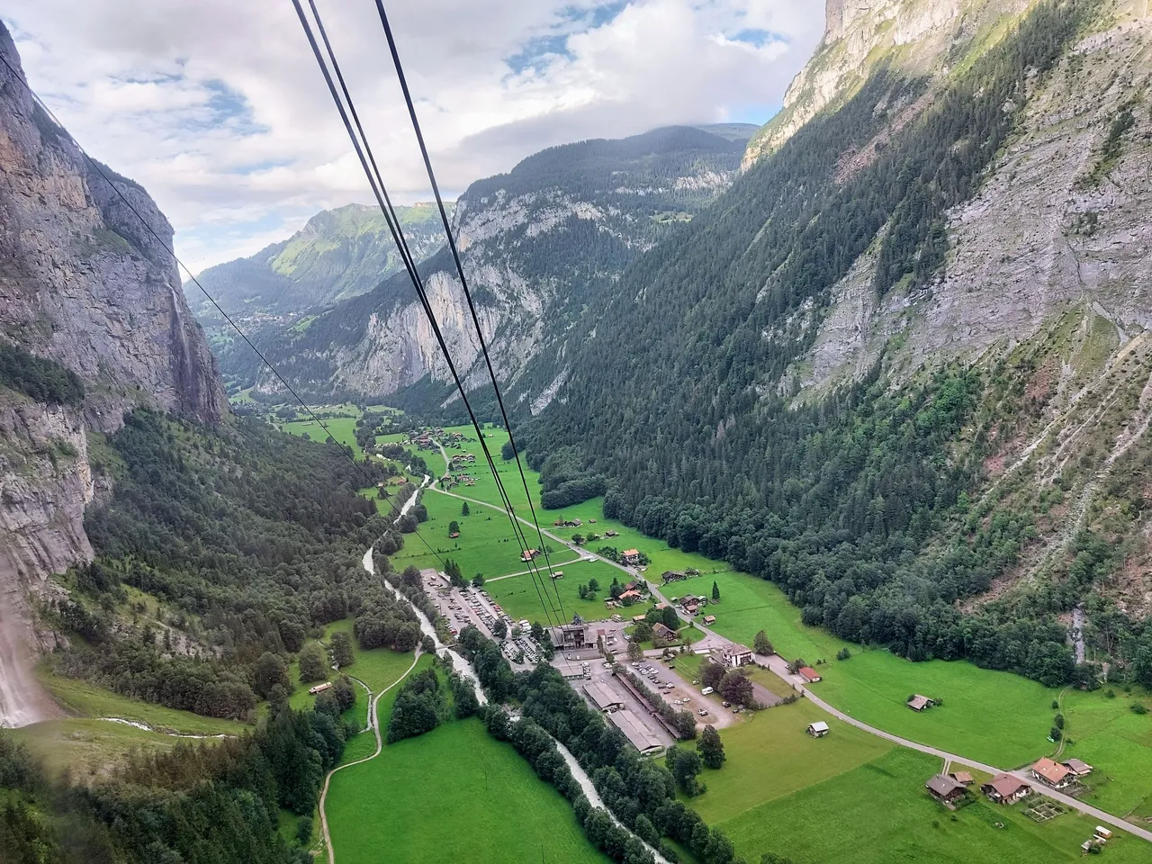
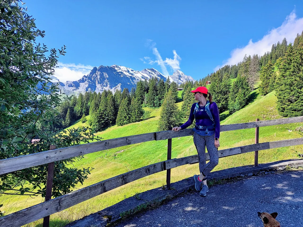
We started our journey first thing in the morning at the cable car station in Stechelberg. If you plan to do this hike I recommend being there as early as possible because the hike to the summit takes the better part of a day if you're a moderate hiker (like us) and the last cable down the mountain from the summit is around 5:50pm. This is important to keep in mind because you don't want to be stuck at the top in high altitude after dark. So make sure that you leave yourself plenty of time to get up before the last car leaves the station.
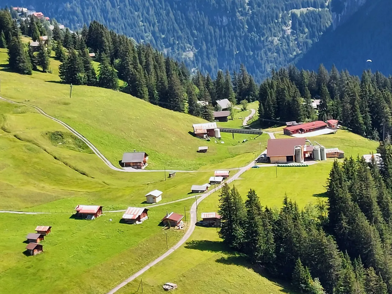
On a side note the photo above shows the trail and road that we walked in my previous post. Around the bend is the town of Lauterbrunnen.
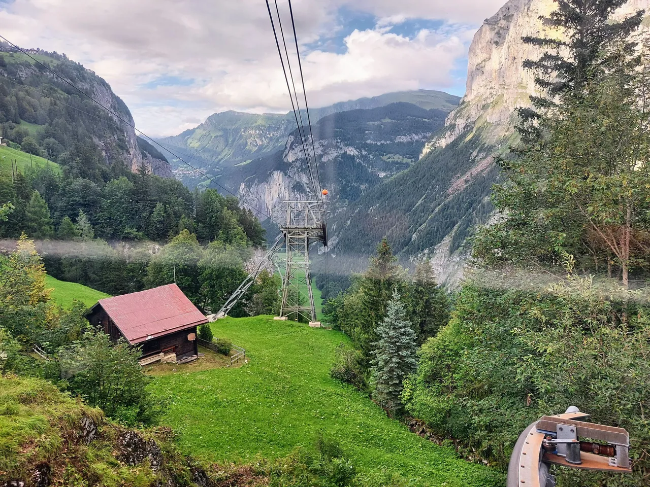
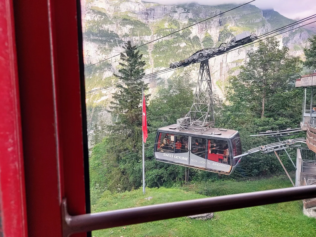
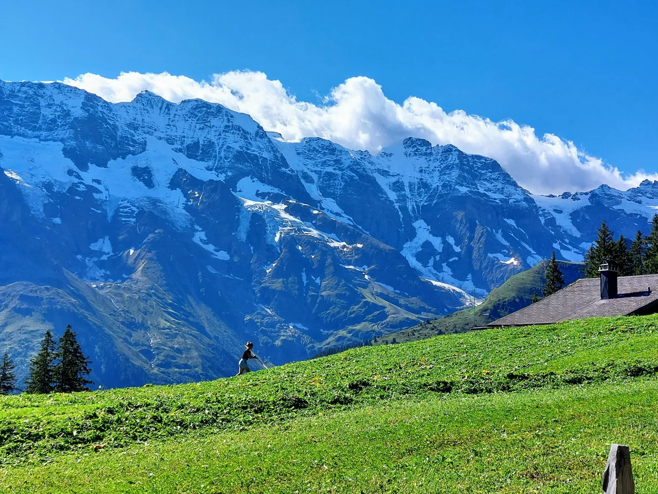
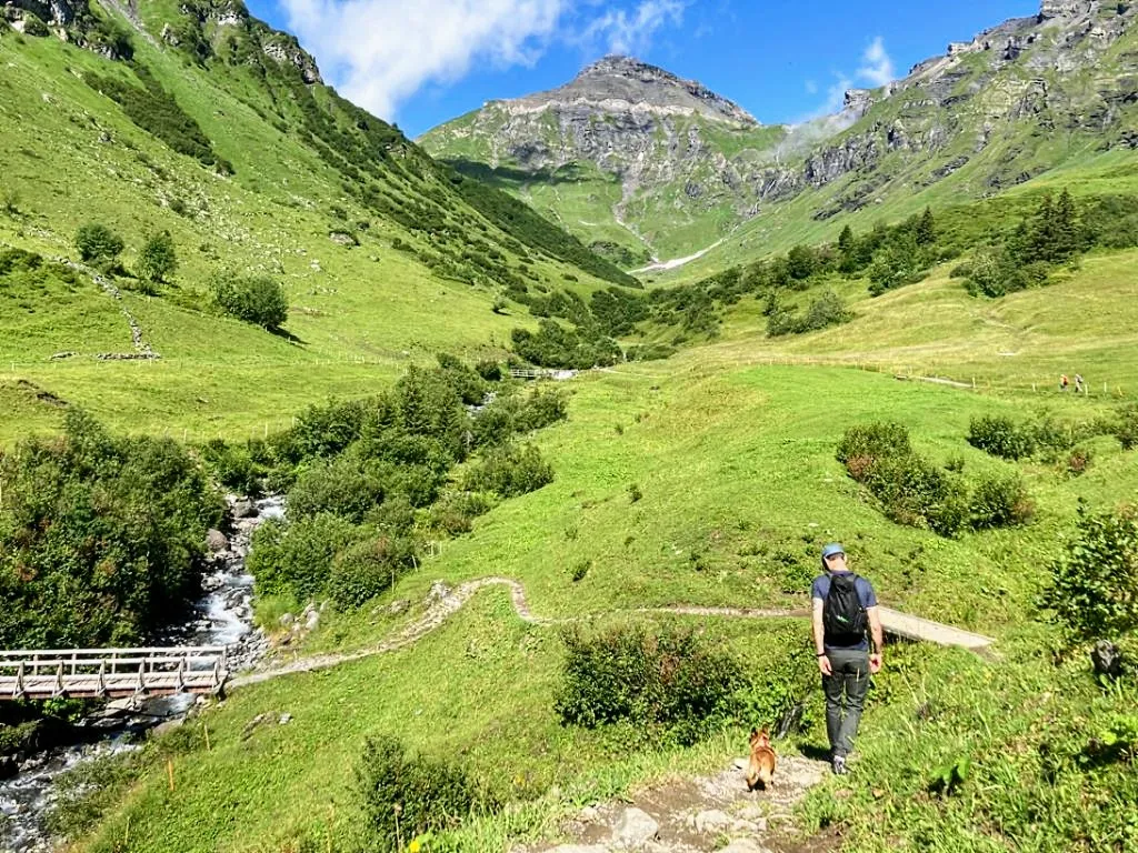
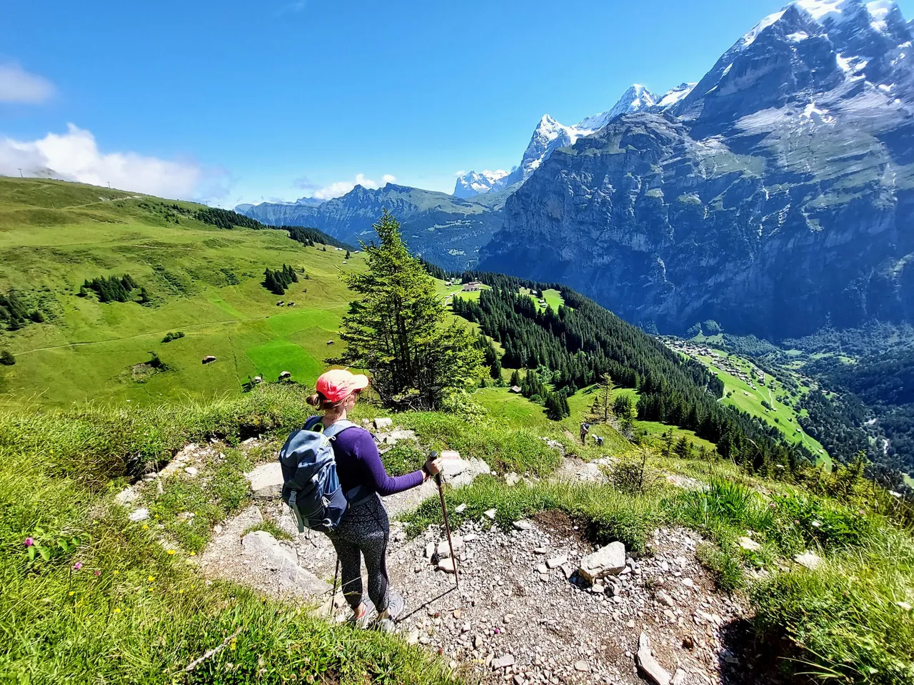
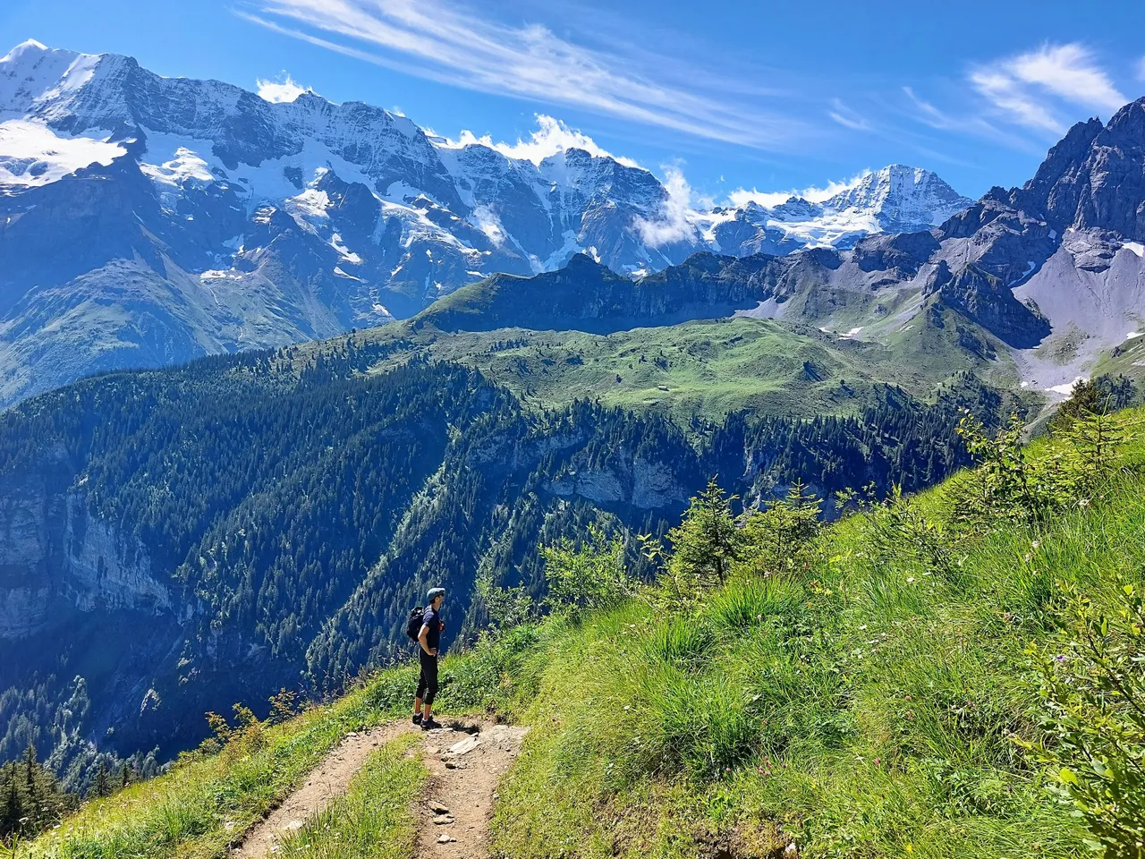
There are a series of cable cars that will bring you up to Piz Gloria if you don't plan to hike it. It costs about 54CHF per person one way or 108CHF return. Most people who hike it though, will take the car up the cliff to the mountain village of Murren and then hike the rest of the way by following one of the trails. This is what we originally planned on doing but then we accidentally made the hike more challenging for ourselves by getting off at the first stop in Grimmelwald. We didn't realize that Murren was the second village and that you needed to jump over to a different cable car to get there. In hindsight, this was a silly mistake because the procedure was really quite obvious. We weren't even suffering from dizziness of high altitude yet!
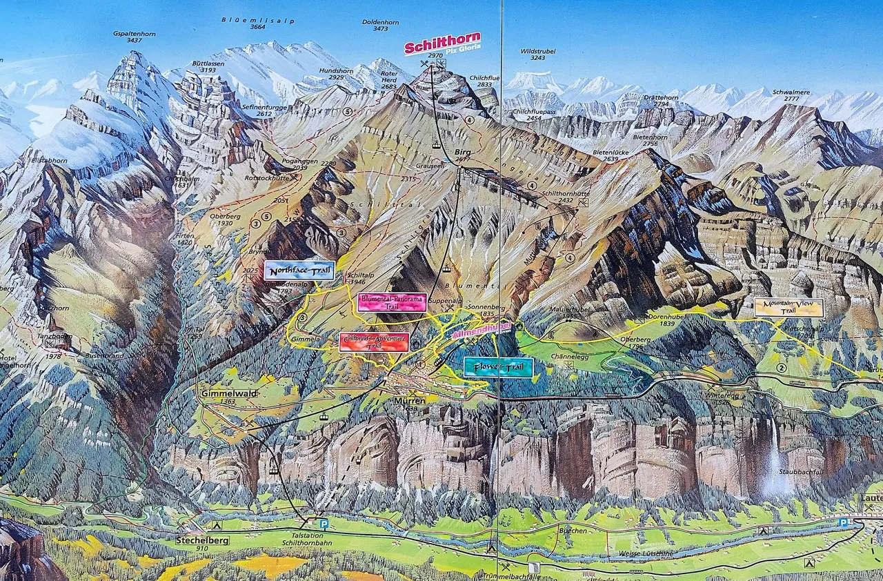
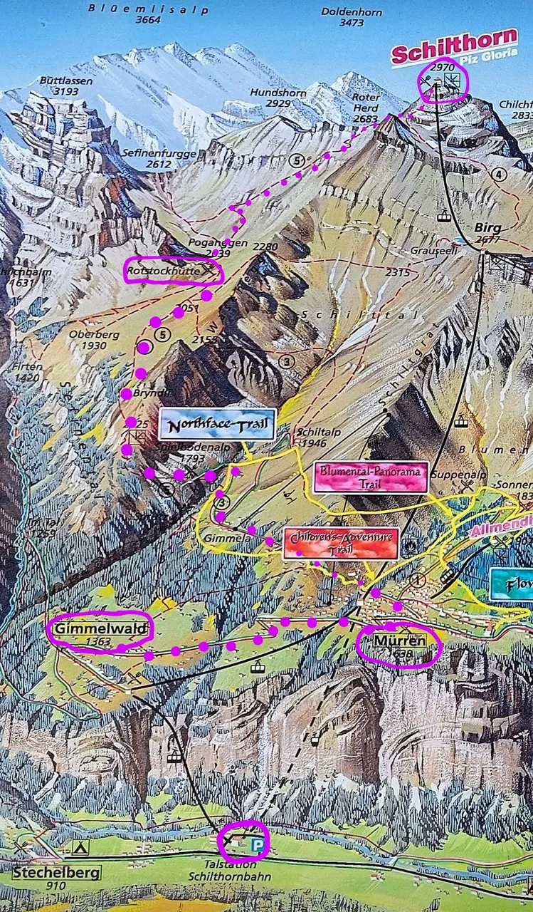
Anyway, the mistake meant that we needed to walk an extra 60 minutes up hill to get to Murren, then from Murren we walked to Rotstockhütte and then to Piz Gloria via the Rot Hard route. Below is a map of the mountain with the key villages and markers on it. That's followed by a rough outline of the route that we took.
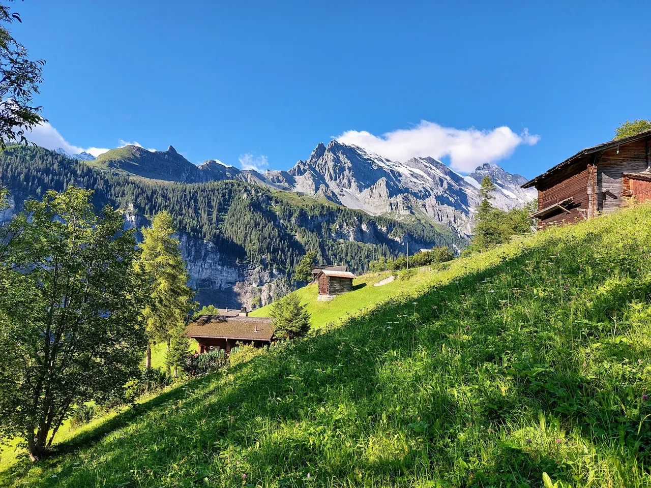
It was more work but it wasn't all bad. Grimmelwald is a nice little village with some amazing views. There are also signs along the road that explain how they protect the mountain towns from avalanches and how they prevent their occurrence in the mountains. It was pretty interesting actually.
I'm not going to lie, the walk up to Murren was pretty tiring for us and it wasn't even the first leg of our actual trip. The dog made things more challenging for me as well because the overall trip was starting to take its toll on him by this point. I noticed the day before that he had started limping a little during our walk. So this day I figured I'd let him walk the begining of the hike where it was smooth and easy and then carry him on the back half where it was steep and rocky. But then he started limping again after only 15 minutes from Grimmelwald so it was at that point I started carrying him. I ended up carrying him for the entire hike except for a few brief intervals here and there.
The dog is only about 9kg (20lbs) with the backpack and normally it isn't too bad, but at high altitude with low oxygen, he may as well have weighed double that. Hiking at high altitude is exponentially harder than at low altitude because of the reduced oxygen levels and we were going up to 2970m (9745ft). The last 1/3 was absolutely dreadful. It was also the most difficult terrain so literally every step became a struggle. My wife was also carrying a backpack with our water bottles, our rain coats, some trail mix and a few other odds and ends so it wasn'teasy for her either. But at this point we weren't even in Murren yet so we were still pretty fresh and energized.
The cable car to Murren cost about 20CHF per person and takes only about 15 minutes but you can find more information on prices and schedules by visiting the official website here.
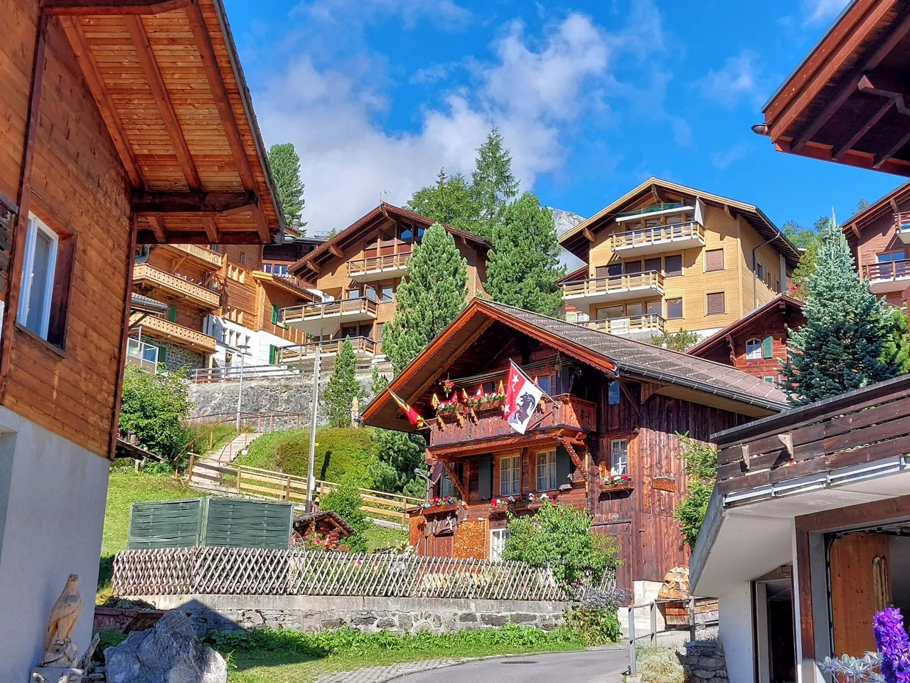
After arriving in Murren we took a few quick photos and then immediately continued on our journey up the mountain. We chose to take the Rotstockhütte route but there are other routes as well, all of which are marked clearly all along the way.
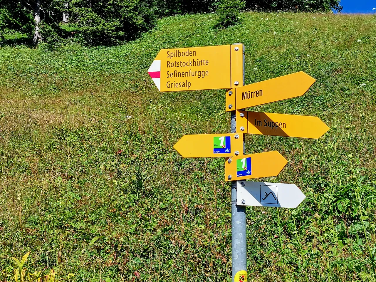
At this point though the Schilthorn summit isn't listed on the markers so you do have to know one or two of the stops along the way to your final destination. For instance, Rotstockhütte or Birg...etc.
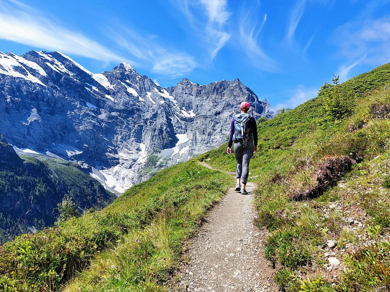
Murren to Rotstockhütte
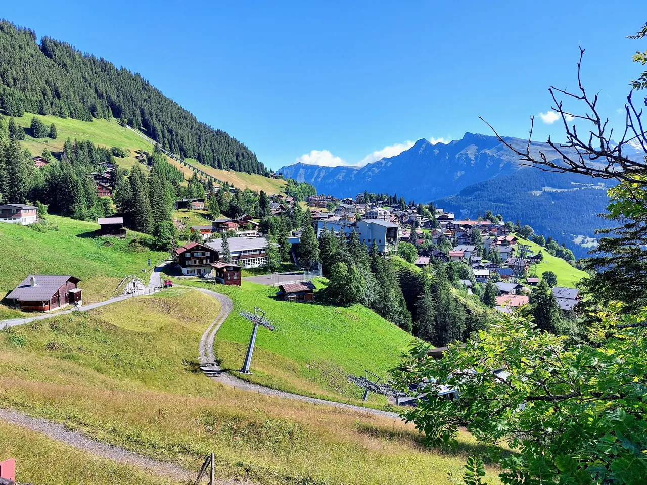
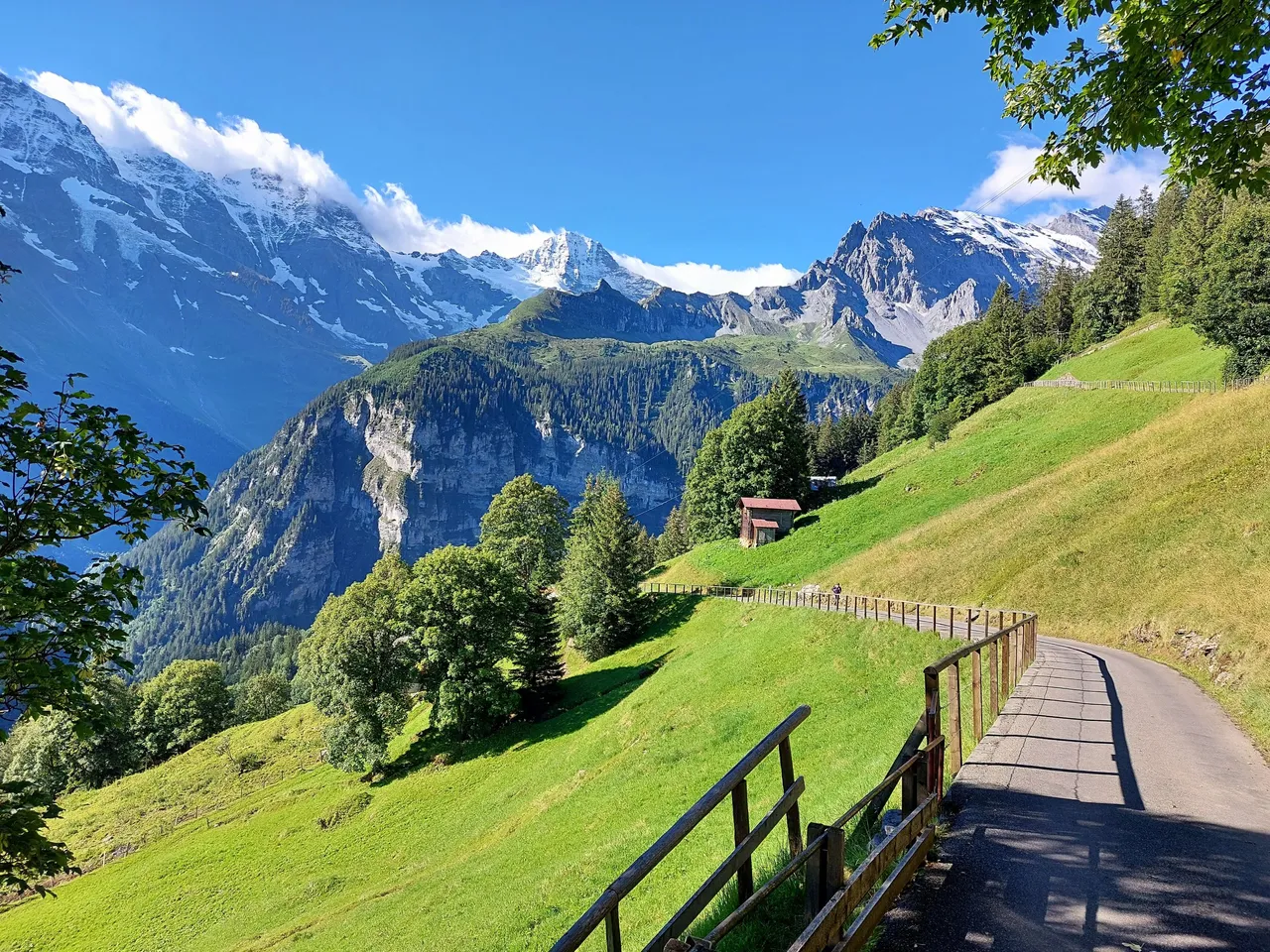
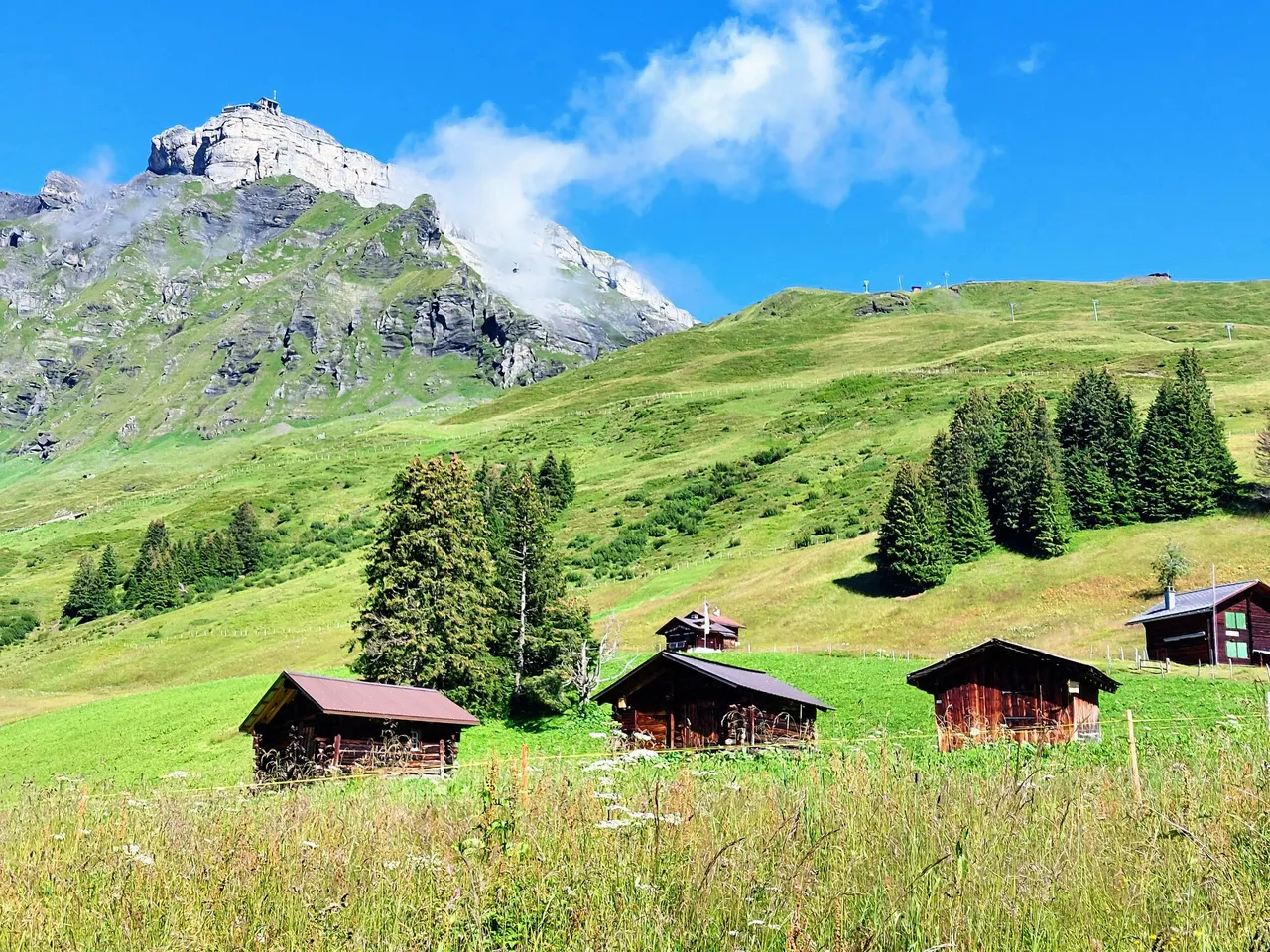
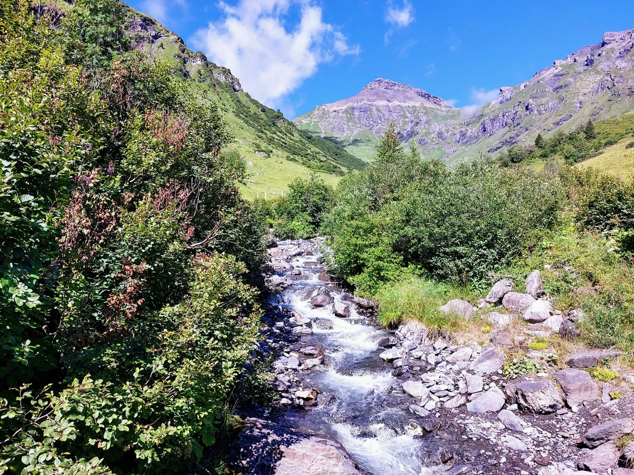
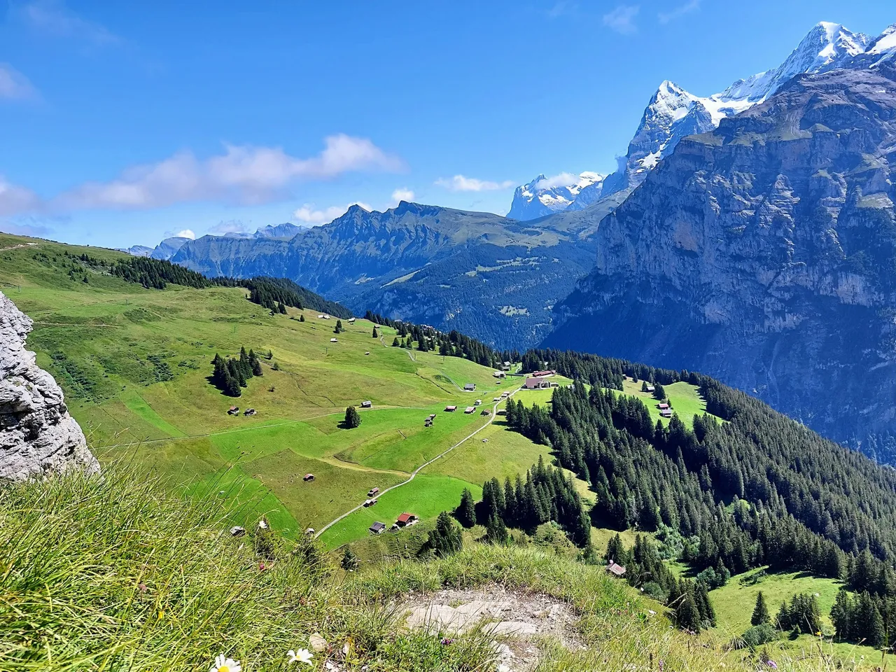
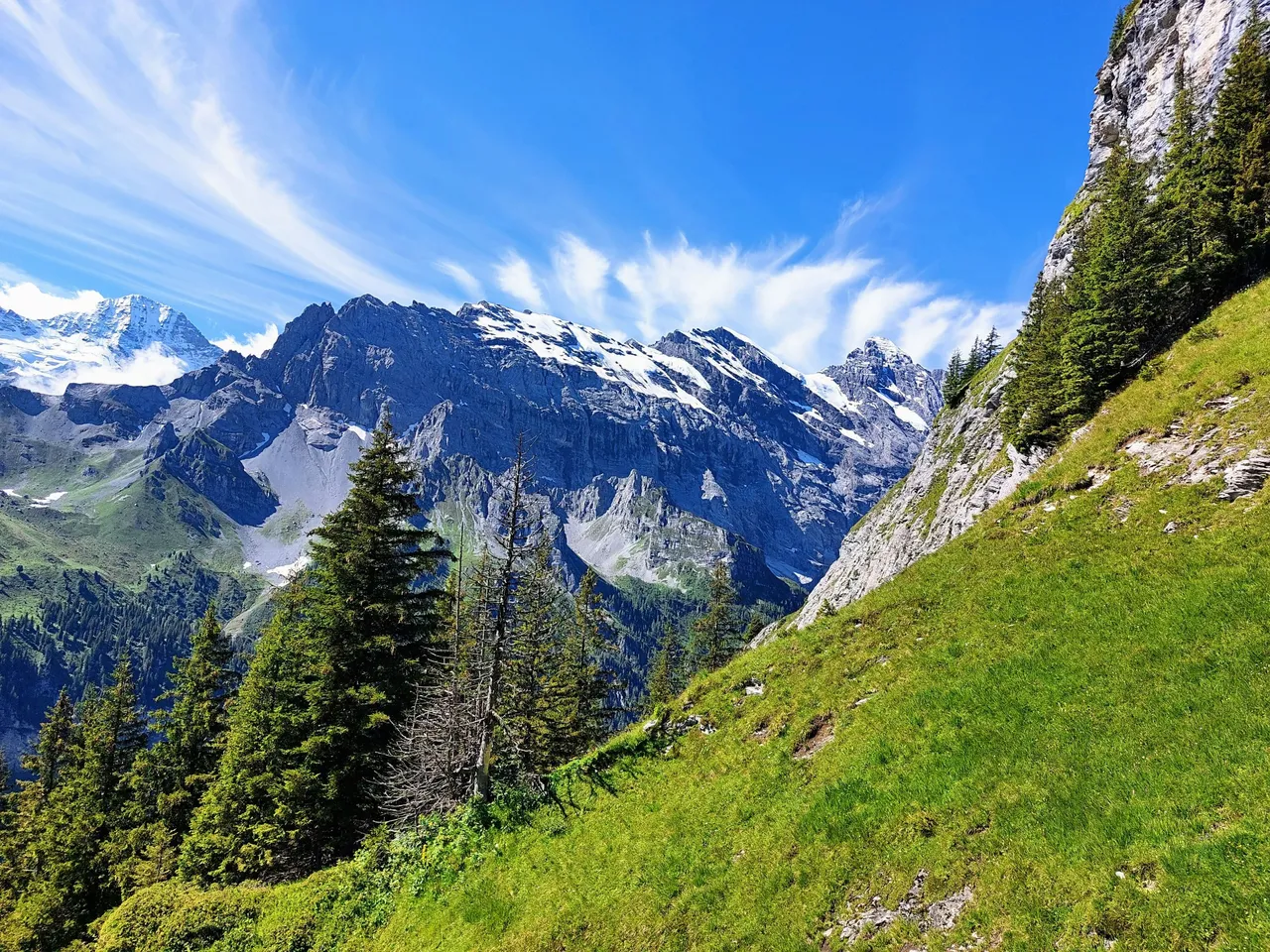
Aside from being completely picturesque, the hike from Murren to Rotstockhütte was pretty easy, especially when comparing it to what comes after. It's entirely uphill but it's mostly a gradual incline along a paved road or dirt path, nothing like the last 1/3 to the summit.
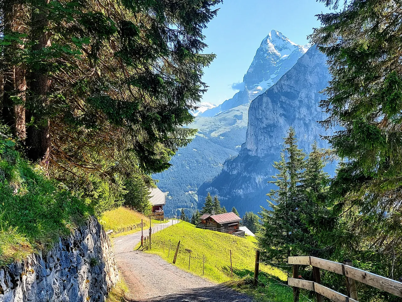
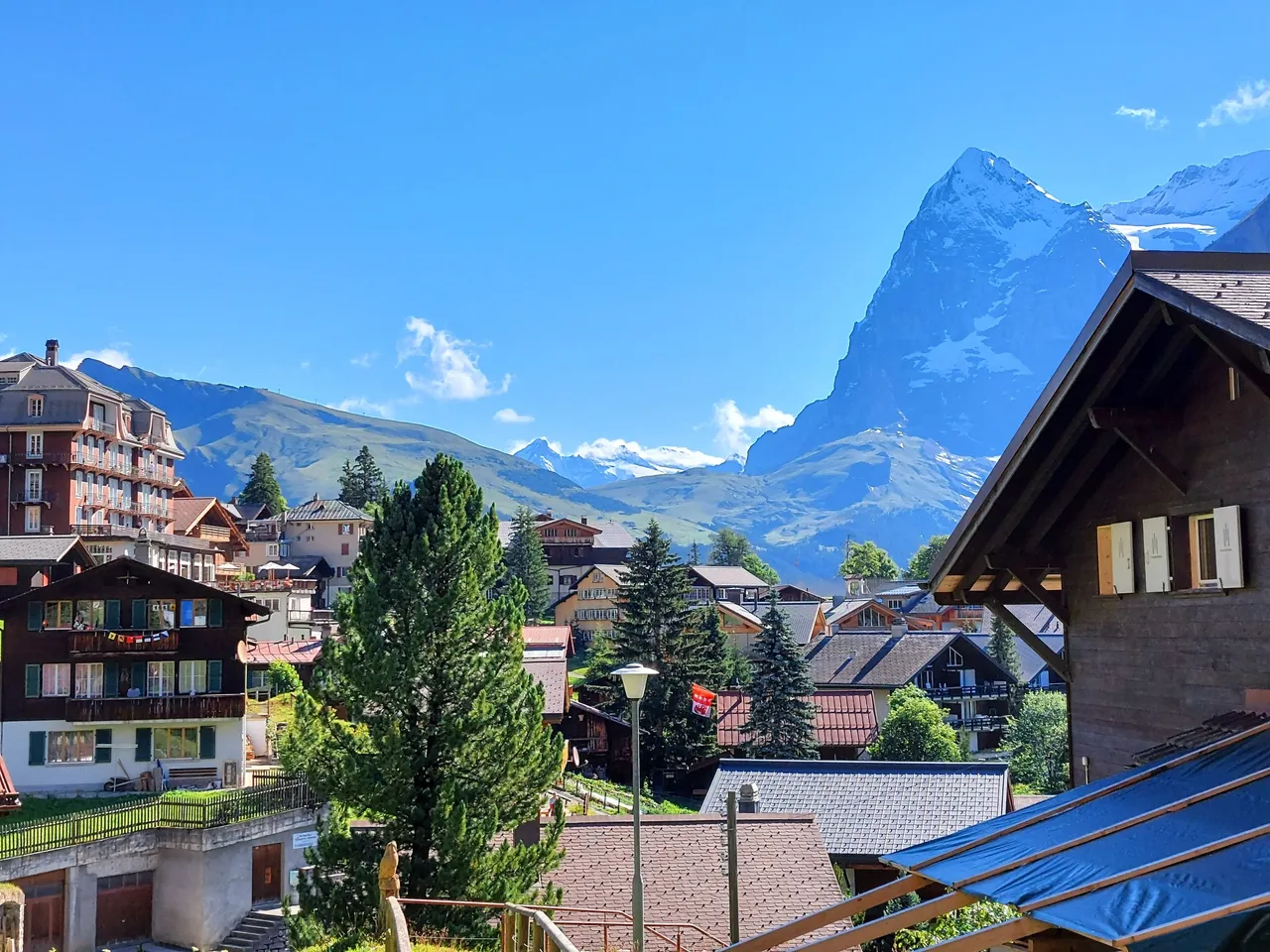
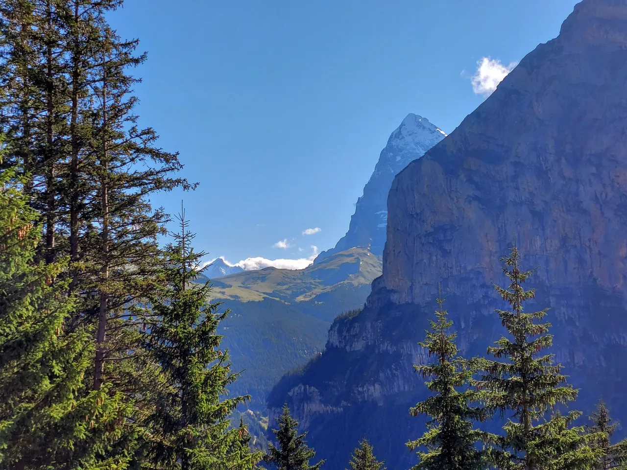
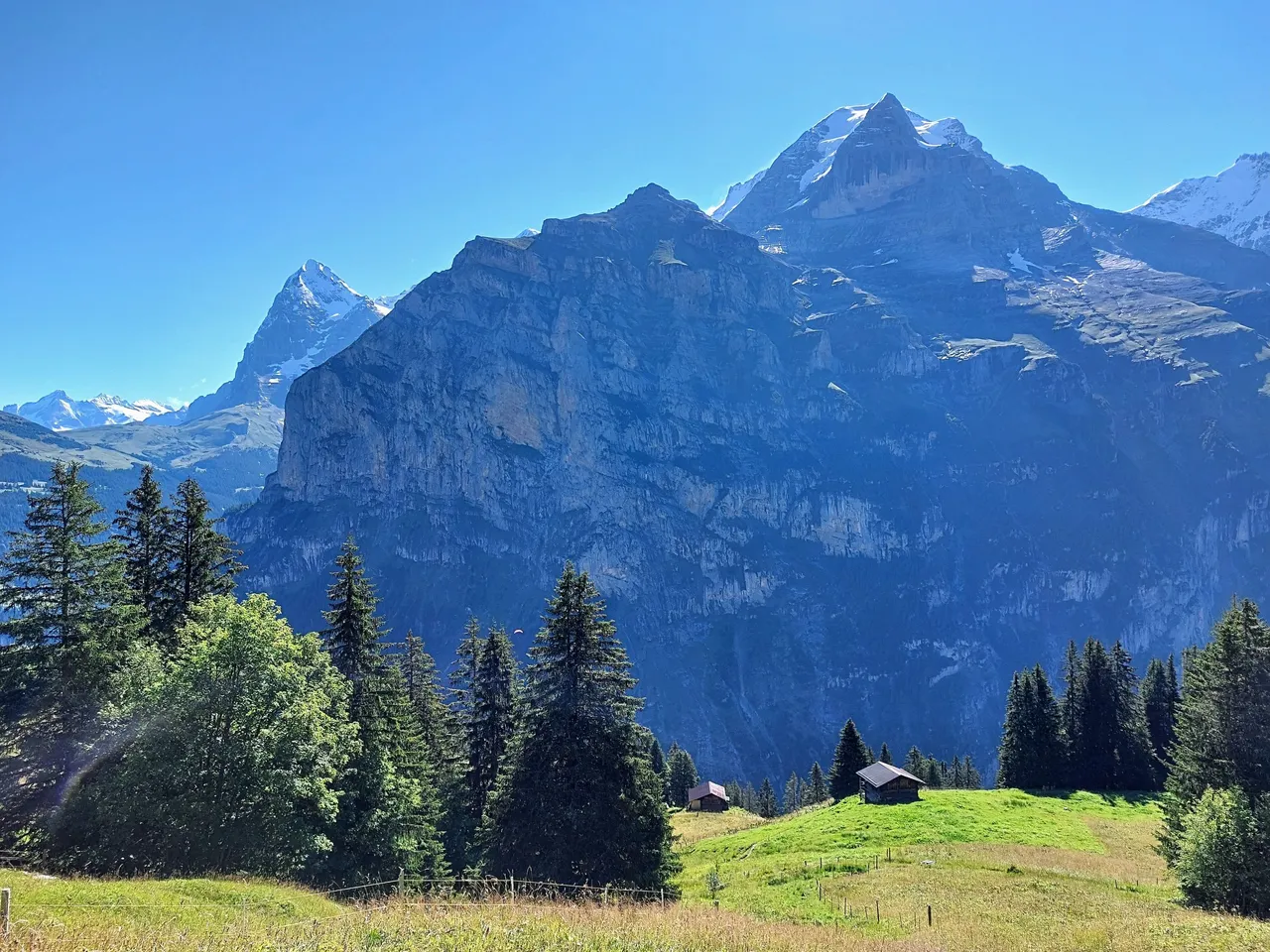
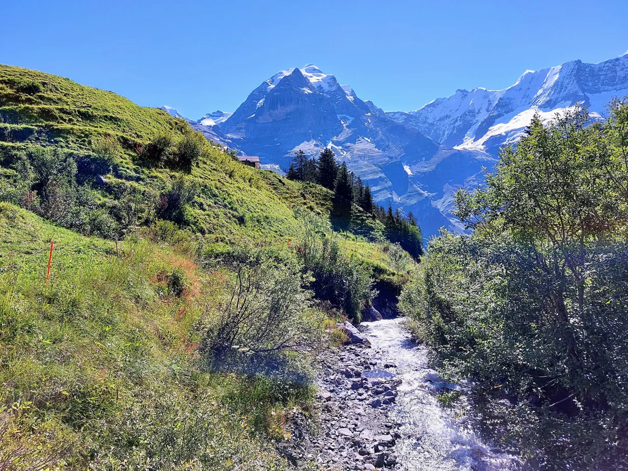
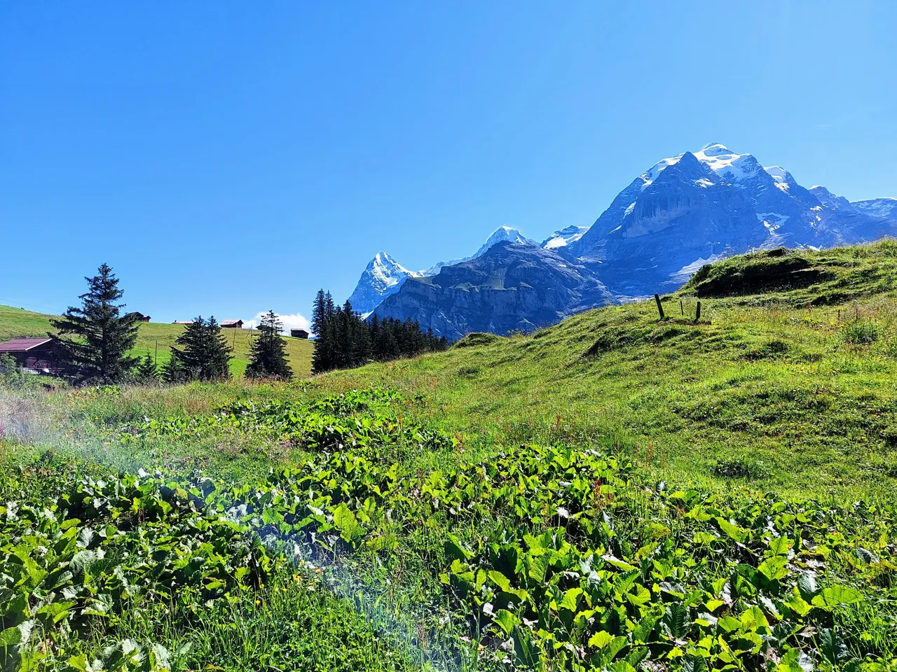
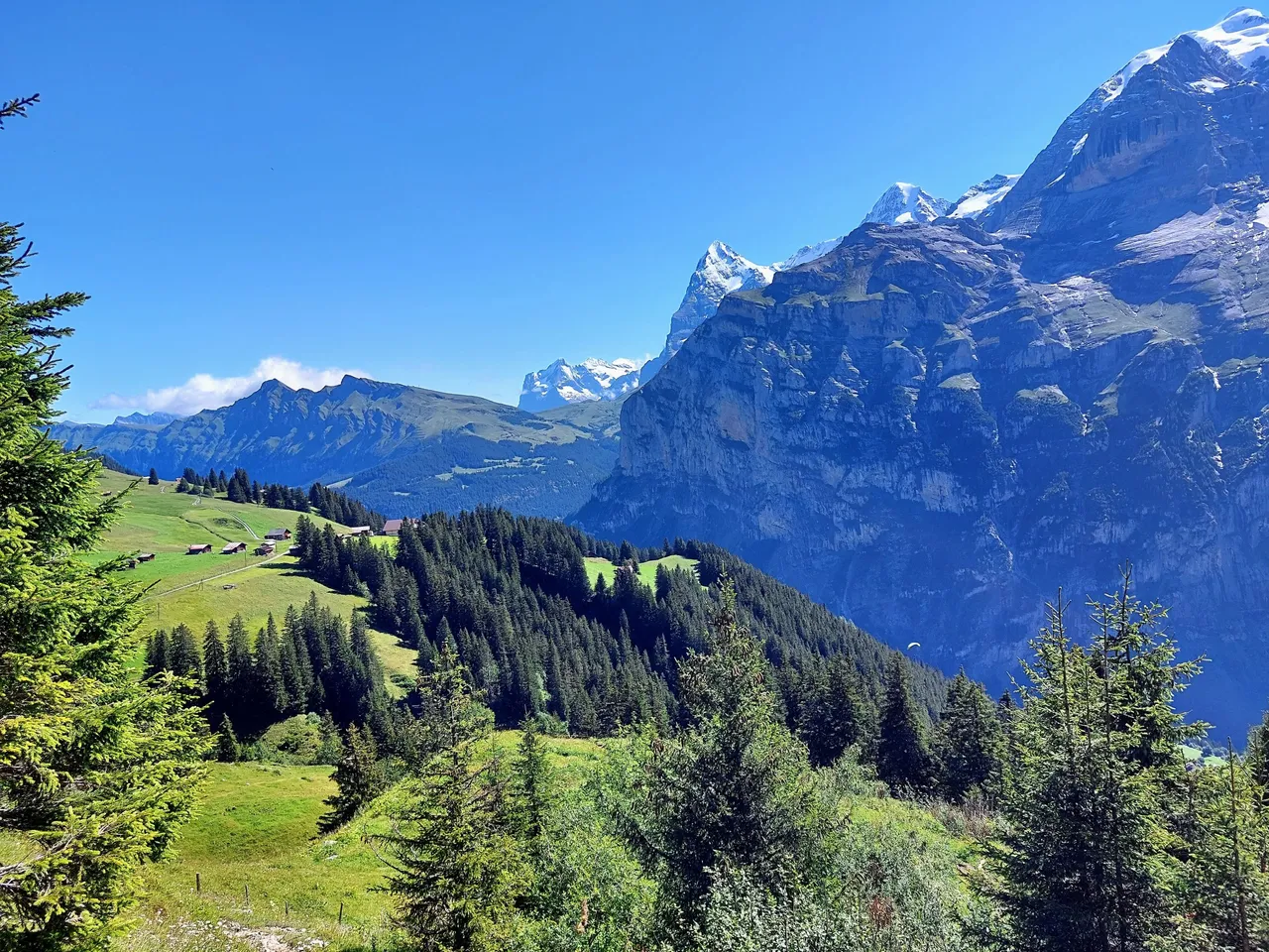
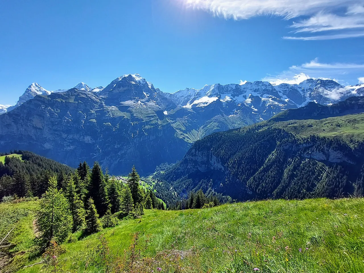
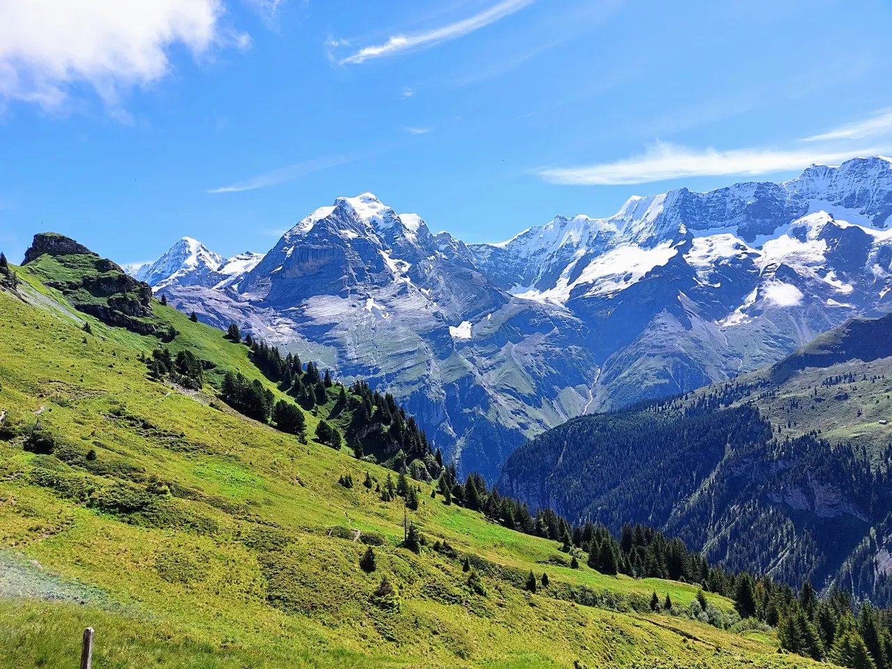
The town of Murren is directly opposite one of the most recognizable mountain ranges in the country of Switzerland. It's made up of Mount Eiger, Monch and the Jungfrau, all of which can be seen for a better part of the hike.
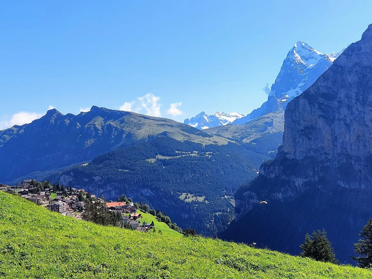
You can see mount Eiger in the photos above and below. It's supposedly a very technical and difficult mountains to climb and from the photos it definitely looks that way to me.
The next two photos are of Monch with mount Eiger in the background. You can also start to see mount Jungfrau in the second photo which is the tallest of the three.
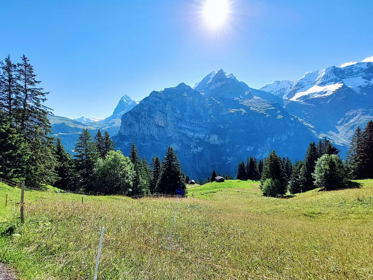
Even though we were quite high up at this point there were still quite a few houses and farms scattered throughout the area. There were plenty of cows during the hike but none whatsoever at this point. Surprisingly they were still much higher up the mountain.
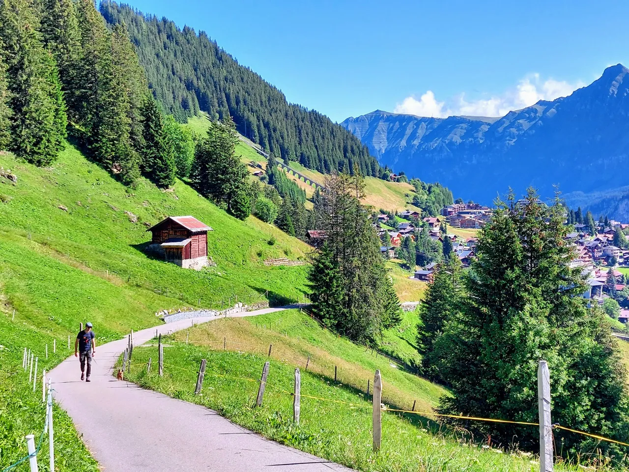
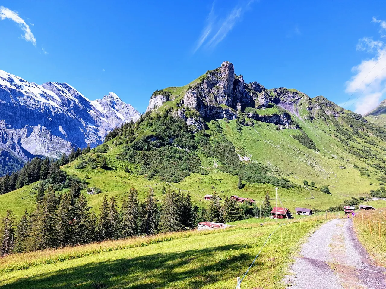
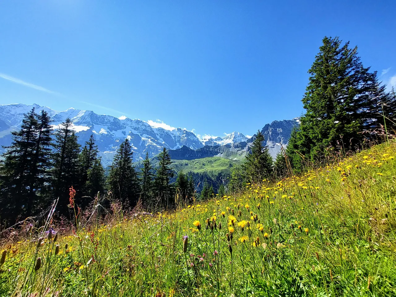
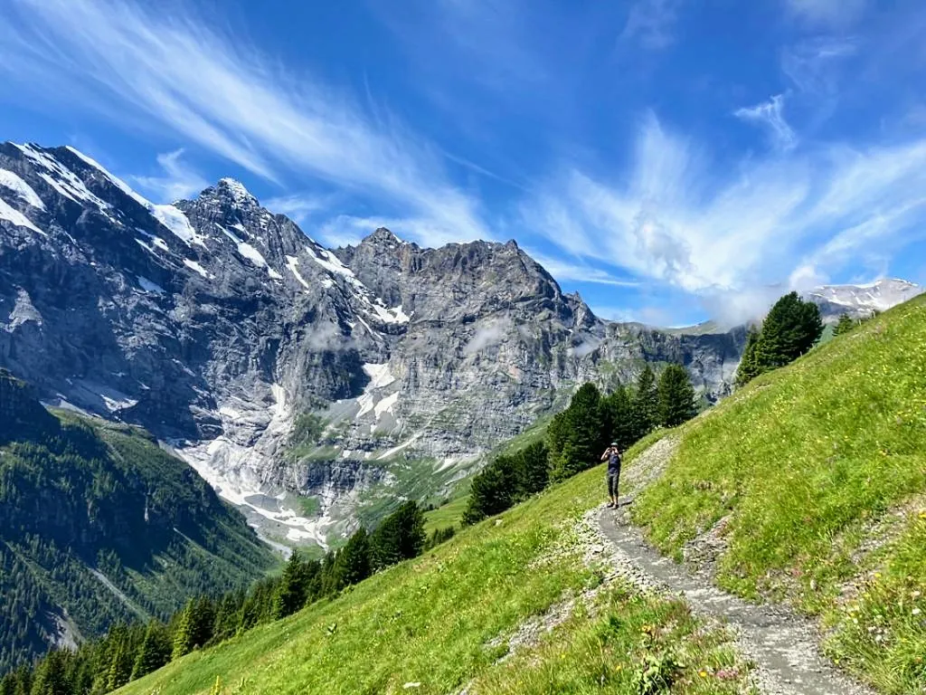
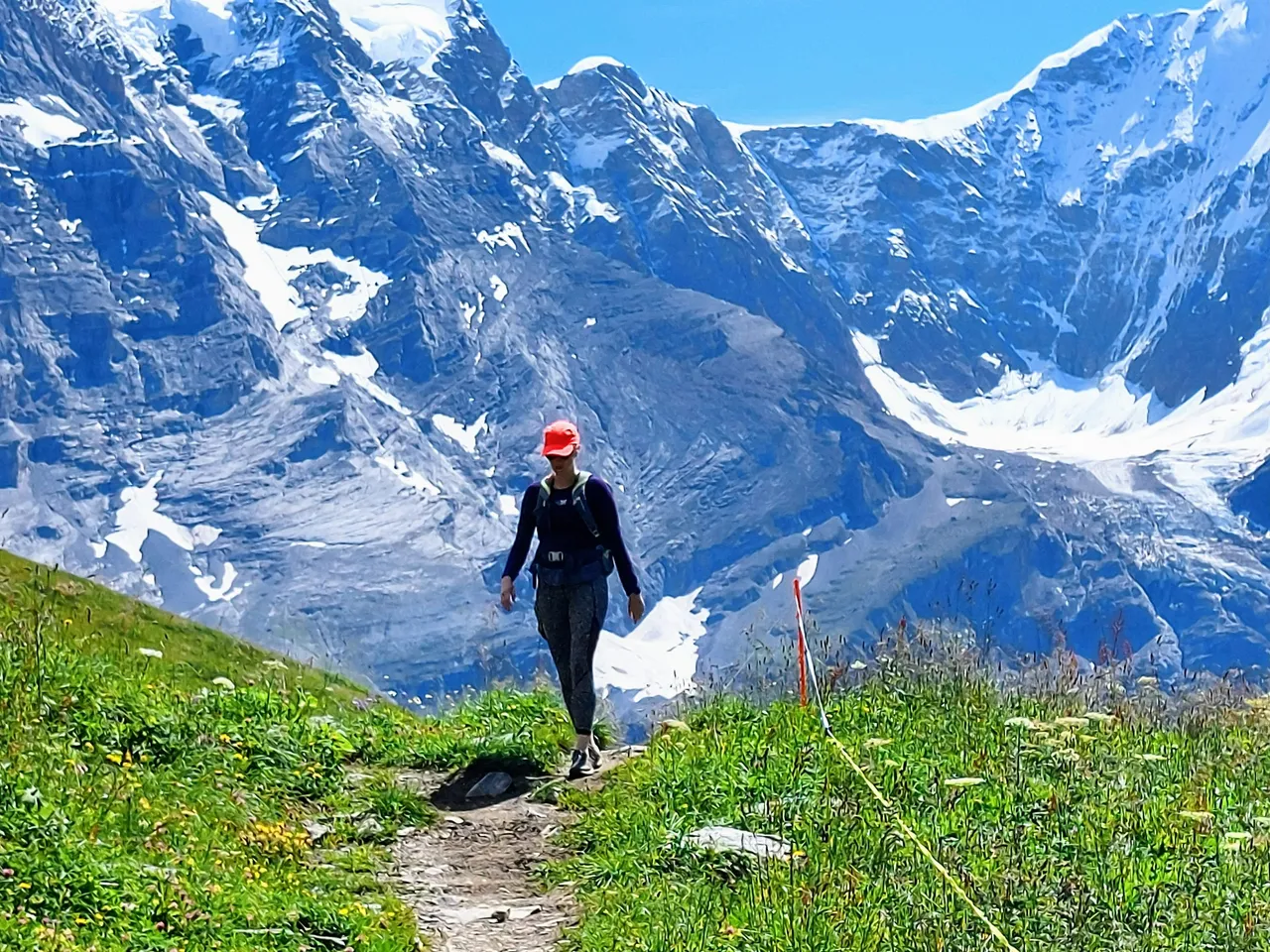
The landscape began to change a little as we made our way along the road. I noticed that the trees were a little less abundant and that the grass seemed to get a little thinner. It was here where the hike also got a bit more challenging.
It wasn't technical by any means but it definitely got a lot steeper. The large road turned into a narrow dirt path which went right up the rocky bit in the photo below.
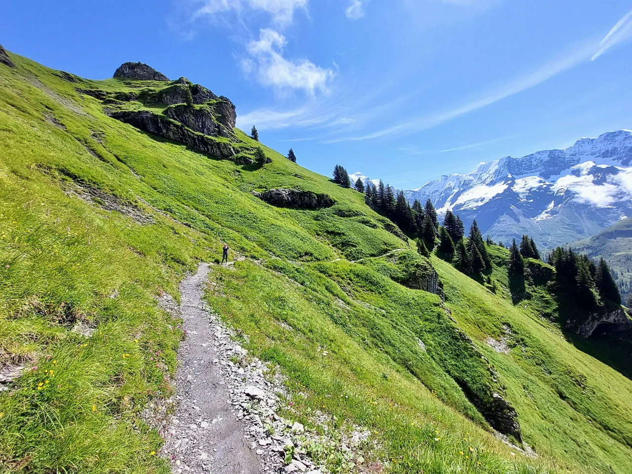
Switchbacks here we come!
Luckily the dog was able to walk for a bit to give me a break before the coming incline but from there I mostly had to carry him in my arms. Sometimes it's just a little too much work to put him in the backpack. Especially if he needs to go in and out multiple times.
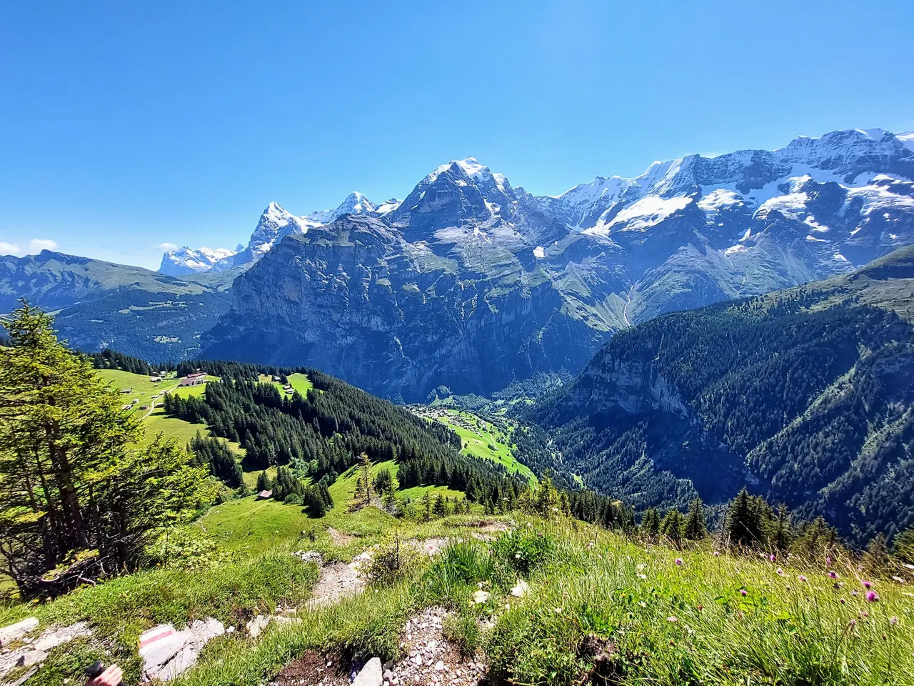
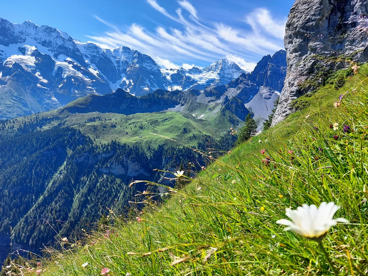
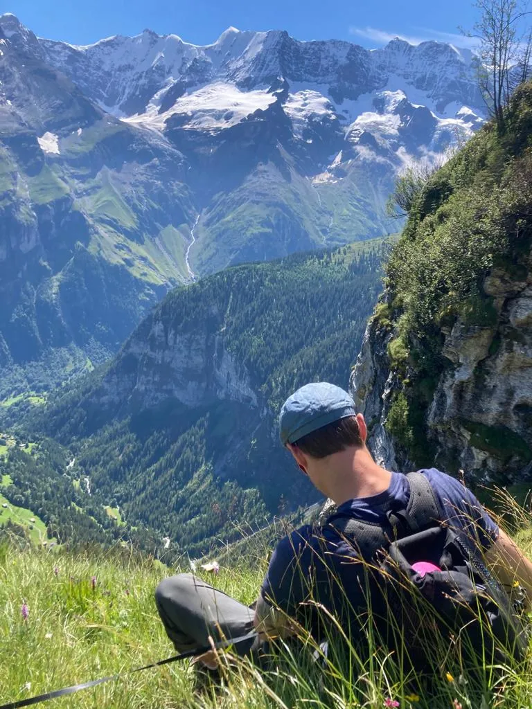
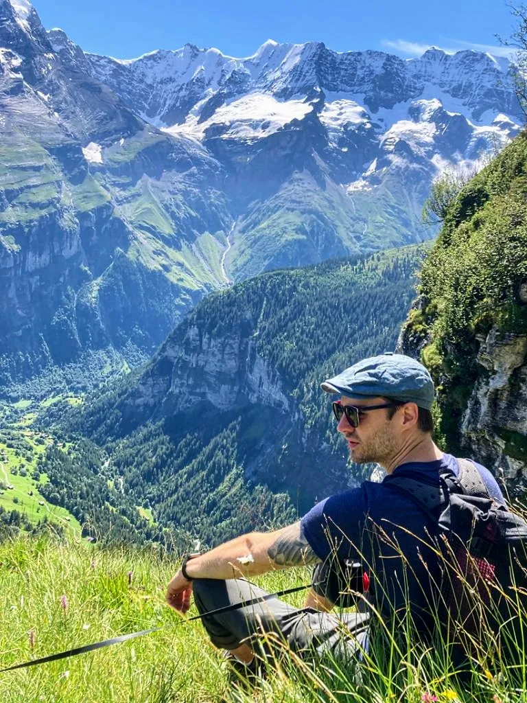
In the photo above you can see mount Jungfrau and below that are the three mountains all together. Quick fact, mount Jungfrau has an elevation of 4158m (13,640ft).
As we began our climb up this stretch we got a glimpse of a few of the farms down below. I'm thought that this was one location where they milk the cows and make cheese during the summer months but since we didn't actually see any cows when we passed by that area I really have no idea. Maybe these were just a store houses for hay for the winter months?
The farms and villages got smaller and smaller as we continued our climb and we became more and more in line with the mountains across the way. In some places we found that we were no longer looking up to them but rather were now looking across at them.
We didn't really notice the effects of the altitude at this point but we still had to take a few breaks along the way.

Breaks are a great time to take photos anyway. I was surprised at how many wild flowers were growing that high up.
If I'm remembering correctly the walk from Murren to Rotstockhütte takes roughly two hours to complete and at this point we still had a ways to go.

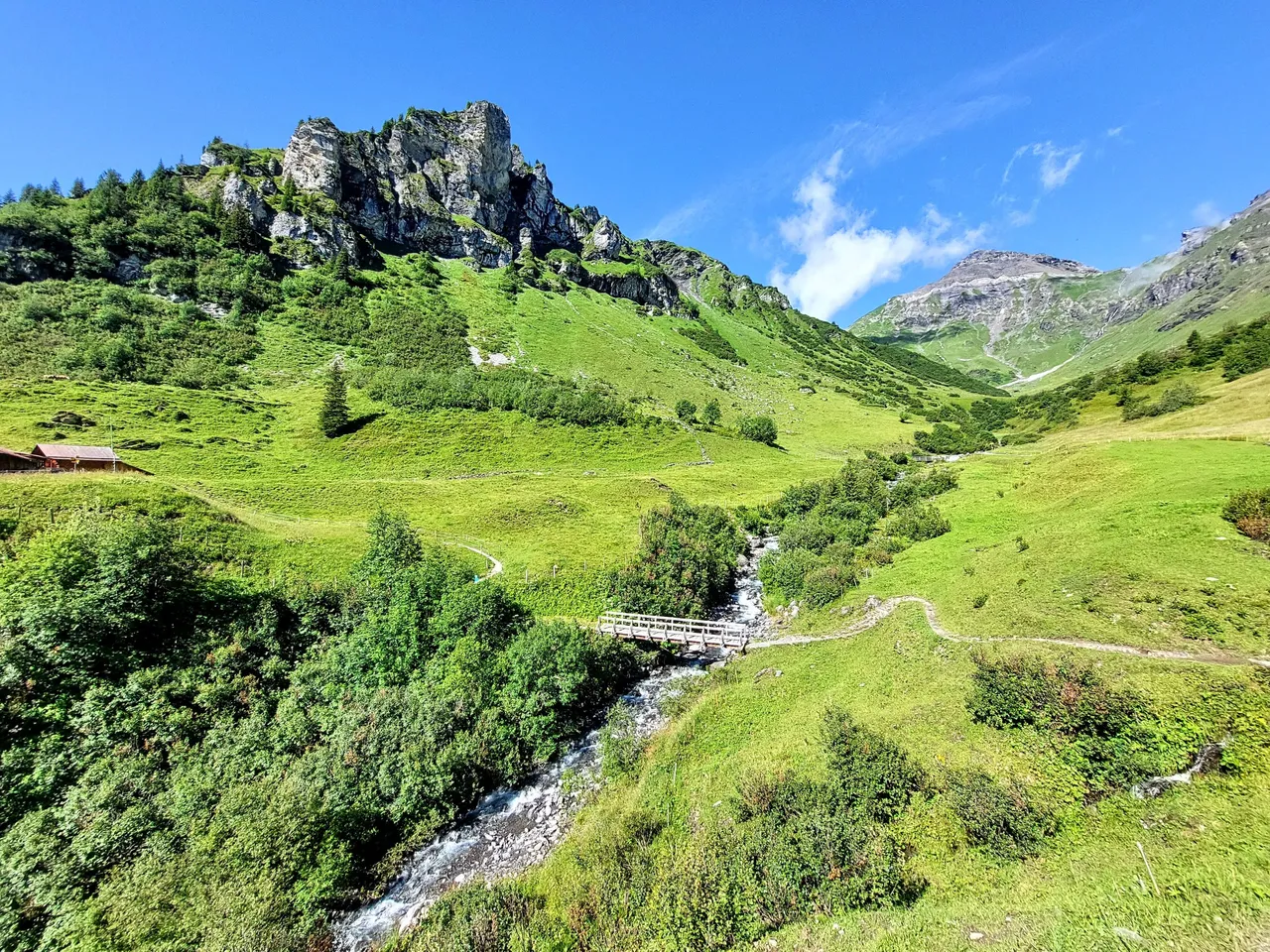
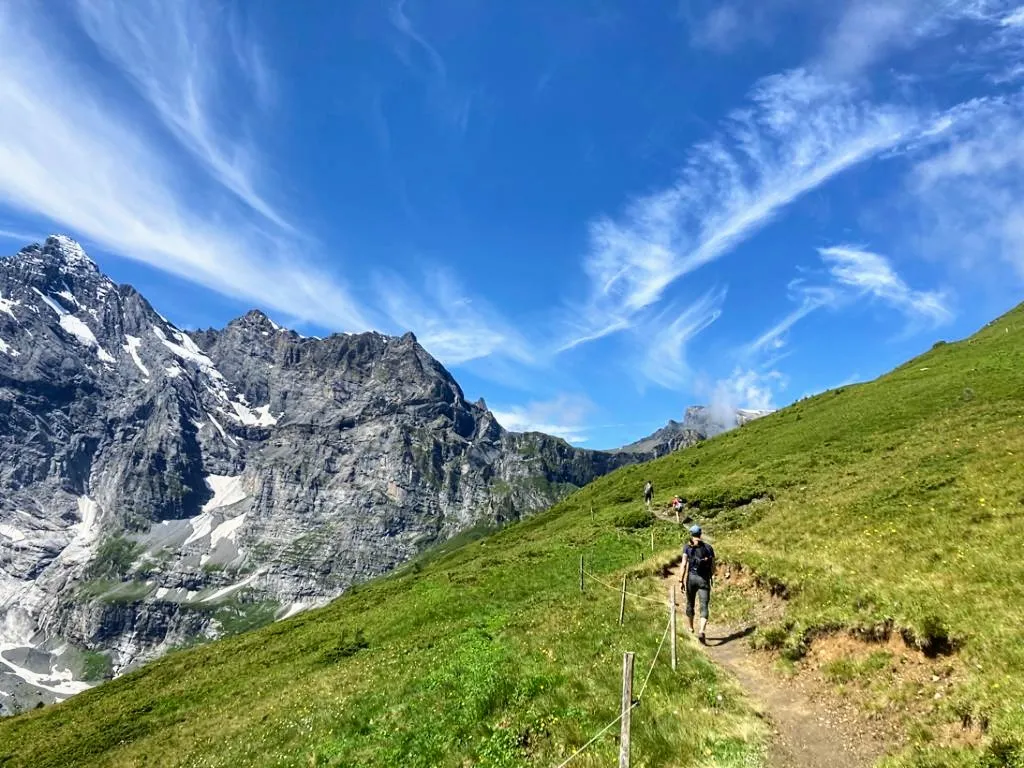
We took one more break on the steep incline and then things actually got a bit easier from there on, at least up until we got to Rotstockhütte. The path was narrow and we had to pause in the grass to let people by and it was actually a little scary given how steep it was. Overall I would say that it was safe but you could still easy fall if you weren't paying attention. If you fell I don't think that you would be able to stop yourself either so it's best to always keep your wits about you.
The incline up the switchbacks is the hardest part to Rotstockhütte but once you pass it the path is mostly horizontal. It felt like a regular walk in the park, or I guess in this case in the mountains.
Get ready for a bunch of photos of me and my wife walking!


After rounding a bend we got our first glimpse of Rotstockhütte off in the distance but we still had about 30 minutes of walking to do to actually get there.


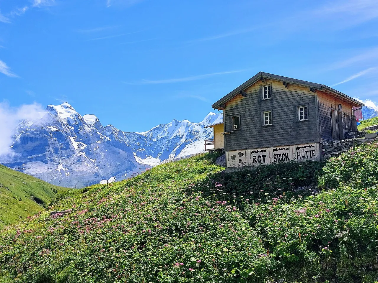
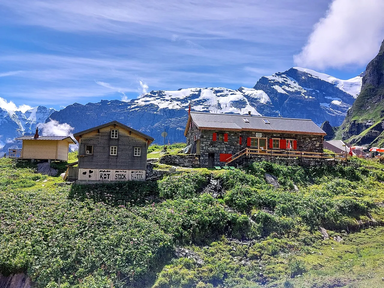
Rotstockhütte
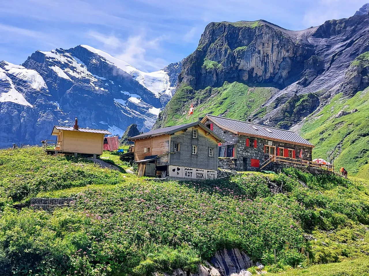
Rotstockhütte is a lodge and restaurant, featuring 45 beds, beverages and simple meals like sandwiches, cakes and Rosti. Rosti is a shredded potato dish thats fried in a skillet until crispy on the outside and soft in the middle.
It's delicious, especially on a mountain!
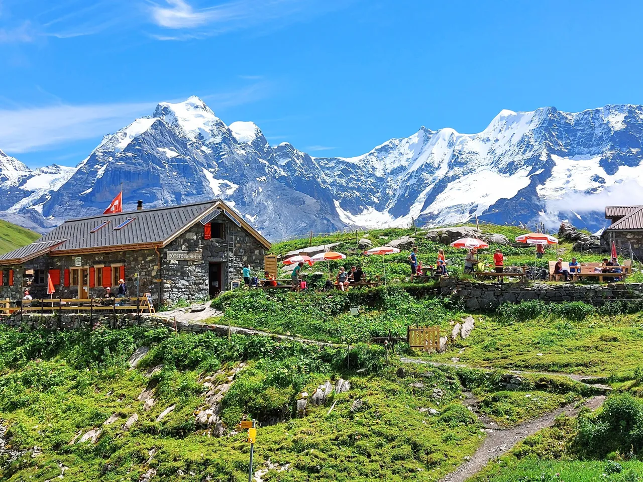
The refuge is located at the foot of the Schilthorn mountain at an elevation of 2039m (6690ft) and is an excellent place to stop for a break and recharge before making the grueling climb up to Piz Gloria.
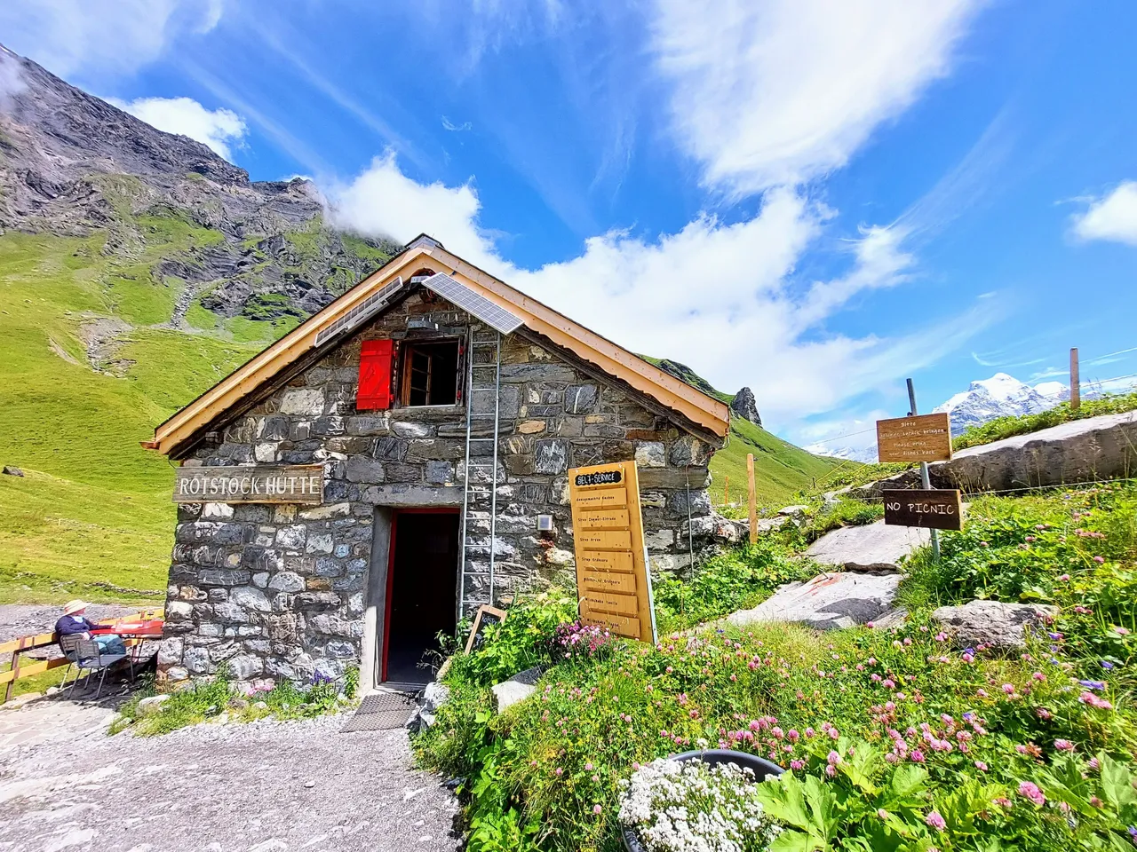
The bathrooms are surprisingly modern and clean given the high elevation and the food is served quickly. We arrived there a little after 12:00 for a beer (cider for my wife) and a Rosti.
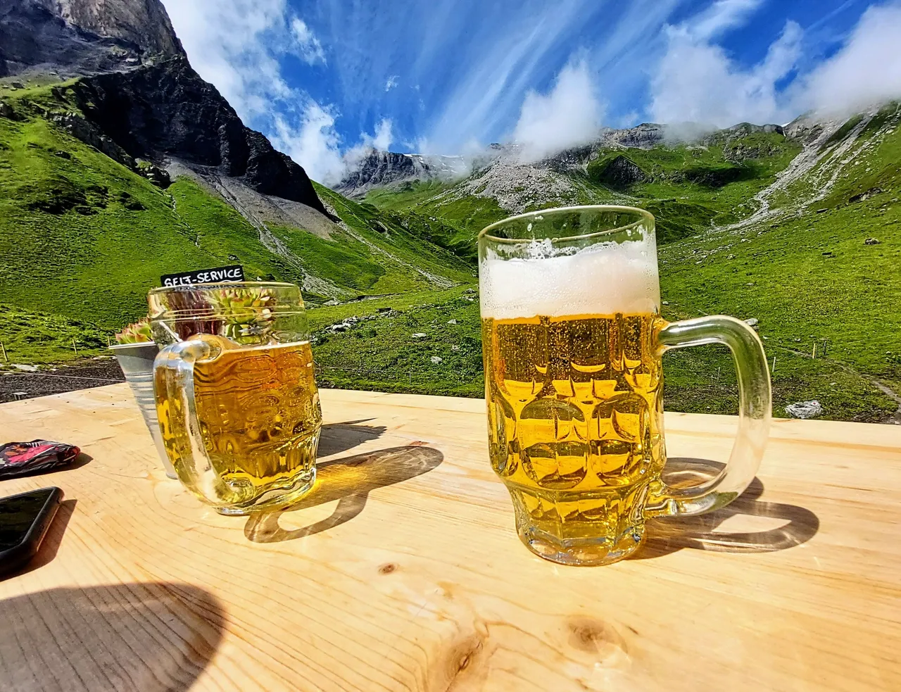
The Rosti was excellent but getting a beer actually ended up being a pretty bad idea and I wouldn't recommend it if you plan to hike to the mountain summit. The high altitude has a serious effect that I didn't realize before ordering it but basically that one beer felt like three. I was actually pretty drunk by the time I finished the glass. Luckily I didn't stay drunk very long because the shear exertion of the climb made me metabolize the alcohol quickly. But it also dried out my mouth and made it taste awful for the remainder of the hike. Imagine having a pint and then going for a long jog on a hot day. It's not a pleasant experience. It was only a minor inconvenience but I definitly wouldn't do it again.
After our brief pause and quick lunch we began our climb to the summit of Mount Schilthorn. Piz Gloria is a three hour hike from Rotstockhütte and most of the elevation gain occurs within the first hour making it a very difficult climb. It's essentially a straight vertical climb to the top. I'll get into that more in part II of the post though. Sorry to end it on a cliffhanger but this post is long enough as it is so I'll save the last 1/3 of the hike for another day.