There is a small, former quarry not far away from where I live. I heard about it when Wikipedia launched a campaign to obtain photographs of sites listed on the "National Register of Historic Places" that had not previously been photographed. As a contributing Registered Editor to the Wikipedia project since 2006, I was definitely interested. This quarry was one of those unphotographed sites and is close to me, so I went to find it — partly out of curiosity, and partly because I really wanted to obtain a photograph to assist the project.
In the 1930s, the Civilian Conservation Corps built several structures on the site of the newly commissioned Table Rock State Park and needed blocks of granite for the project. The structures included a dam and a spillway across a local creek to create a small lake, as well as several buildings such as a lodge, bathhouse, picnic shelters, etc.
When the work on the structures began, granite was obtained from the site of the state park, itself. However, the granite obtained was not as good quality as hoped, and the available granite that was easy to obtain was soon exhausted. Other sources had to be located to supply the quantity and quality necessary. Fortunately, there are copious amounts of granite in the area, and multiple sites were found within a four-to-five mile radius of the construction.
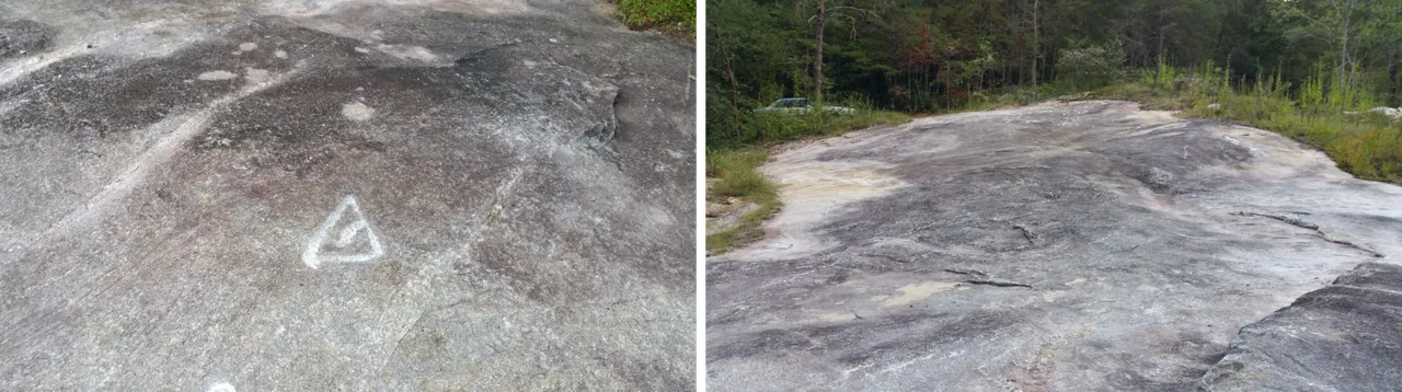
 Aerial view of Quarry № 1, Google Maps view
Before this second quarry (1.3 acres in size) was used, there was a first quarry (4.7 acres in size), which is also on the National Register of Historic Places. It is not far from the second quarry, but I did not attempt to visit because it is down a private drive, and on private property which is much more difficult to access than the quarry I visited. This first site has so many trees that the outcropping is no longer visible on aerial photos, while the granite outcropping of the second quarry is clearly visible from aerial views (see photo at right). Records of this project also indicate a third and fourth quarry were utilized, but their locations were not listed. This makes me assume that they were smaller or not as frequently used as the first two quarries were.
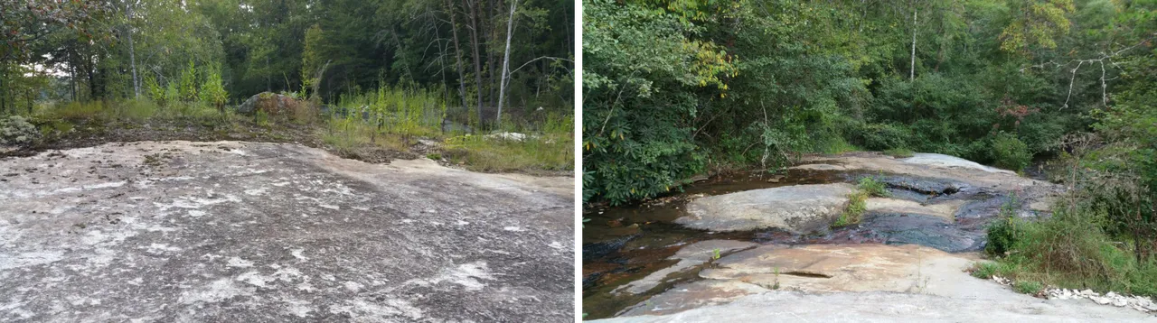
The large granite blocks needed for the project were blasted, rather than cut, from the outcropping. Holes were drilled into the rock at intervals and loaded with dynamite. The blasting was done with such precision that the blocks which were separated from the outcropping were ready to be used, as extracted, without further shaping necessary.[1]
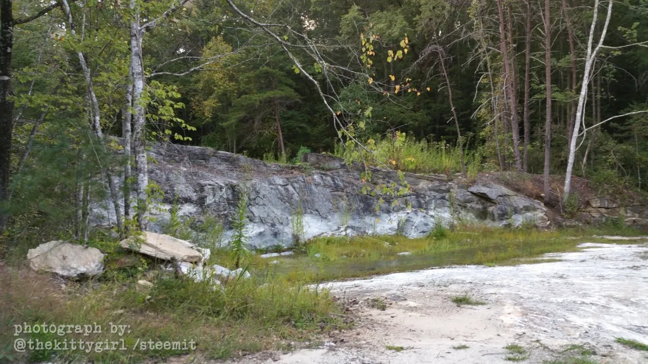
Technically, the second quarry is also on private property. However, it's not far from the main road and runs immediately alongside the private road, so I took a chance. It seemed silly to drive past the quarry (at least the same distance I'd already driven) to attempt to contact the landowners in-person, then return to the quarry. Besides, I would not be there long, and no one likely would even know I was there. Thankfully, there were no signs proclaiming "No Trespassing," and I was careful to leave the site exactly as I found it, not even removing a souvenir pebble. If the landowners happen upon this blog post in the future, please know I am grateful for this peek at the historic quarry. The following photo shows a couple of chairs, which indicate the property owners likely enjoy sitting here sometimes, enjoying the sounds and views of the creek just beyond the chairs.
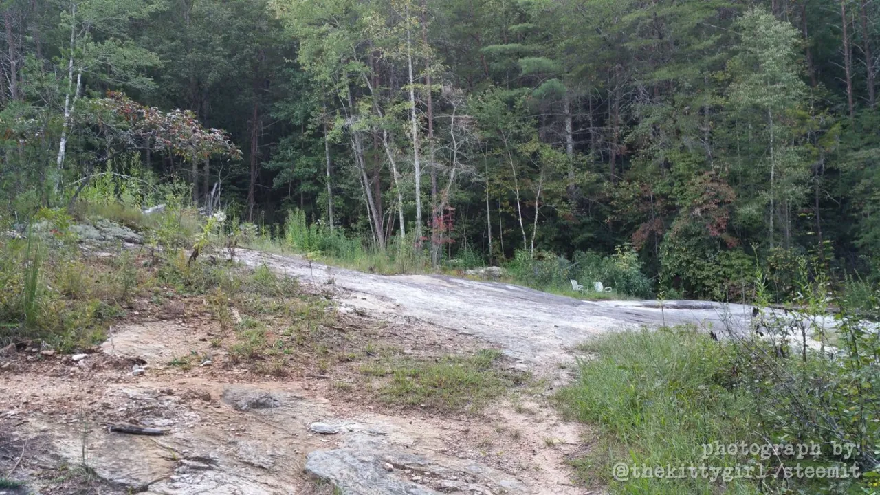
• PHOTO BY ME •
I added the first photo in this series to the Wikipedia article about the quarry. I'd love to get a snapshot of the other quarry, too, and add it to the Wikipedia article about it. Maybe one day I will drive down that other, longer, private road, stop at the house along the way, and talk to the land owners about photographing Quarry № 1 which lies somewhere further along the way.
• PHOTOS BY ME •
There is also one historic house in another part of the county, which is also on the registry and has not been photographed. If I can get a shot of it, too, then all NRHP listings in the county will be pictured!
 😊
😊
SOURCES
1 LandmarkHunter.com: Civilian Conservation Corps Quarry No. 1
2 LandmarkHunter.com: Civilian Conservation Corps Quarry No. 2
3 Wikipedia: Civilian Conservation Corps
4 Wikipedia: Civilian Conservation Corps Quarry #2
5 Wikipedia: Table Rock State Park, SC
!steemitworldmap 35.005532 lat -82.721620 long Pickens County, SC D3SCR